Area Overview for B14 6NB
Photos of B14 6NB
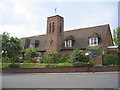
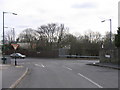
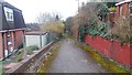
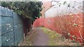
24 photos from this area
Area Information
Key information about the B14 6NB including its size, population, and administrative classification.
- Area Type
- Postcode
- Area Size
- 1.8 hectares
- Population
- 1923
- Population Density
- 5083 people/km²
House Prices in B14 6NB
45
Properties
£176,211
Average Sold Price
£50,000
Lowest Price
£315,000
Highest Price
Showing 45 properties
| Address | Type | Beds | Baths | Last Sale Price | Last Sale Date | |
|---|---|---|---|---|---|---|
| 146 Yarningale Road, Birmingham, B14 6NB | Semi-detached | 3 | 1 | £305,000 | Sep 2024 | |
| 94 Yarningale Road, Birmingham, B14 6NB | Semi-detached | 3 | 1 | £256,000 | Jun 2024 | |
| 100 Yarningale Road, Birmingham, B14 6NB | Semi-detached | 3 | 1 | £260,000 | Jan 2024 | |
| 120 Yarningale Road, Birmingham, B14 6NB | Semi-detached | 3 | 1 | £227,000 | Mar 2023 | |
| 90 Yarningale Road, Birmingham, B14 6NB | Retail | 3 | 1 | £315,000 | Apr 2022 | |
| 98 Yarningale Road, Birmingham, B14 6NB | Semi-detached | 3 | 1 | £240,000 | Jan 2022 | |
| 102 Yarningale Road, Birmingham, B14 6NB | Semi-detached | 3 | 1 | £253,000 | Oct 2021 | |
| 134 Yarningale Road, Birmingham, B14 6NB | house | - | - | £260,000 | Mar 2021 | |
| 132 Yarningale Road, Birmingham, B14 6NB | Semi-detached | 3 | 1 | £256,500 | Sep 2020 | |
| 114 Yarningale Road, Birmingham, B14 6NB | Semi-detached | 3 | 1 | £233,000 | Aug 2018 |
Page 1 of 5
Energy Efficiency in B14 6NB
Amenities
Schools
| Rank | School | Type | Entry gender | Ages |
|---|
Explore more schools in this area
Go to Schools tabDemographics
Household Size
One person
most common
Accommodation Type
Houses
most common
Tenure
68
majority
Ethnic Group
White
most common
Religion
N/A
most common
Household Composition
N/A
most common
Age
47
median
Adults (30-64 years)
most common
Household Deprivation
N/A
with no deprivation
NS-SEC
32
in Lower managerial occupations
Explore more demographic insights in this area
Go to Demographics tabPlanning
Planning Constraints
- Flood RiskPremium
- Ramsar Wetland SitesPremium
- Area of Outstanding Natural BeautyPremium
- Protected Nature ReservePremium
- Protected WoodlandPremium