Area Overview for B14 5AN
Photos of B14 5AN
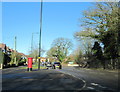

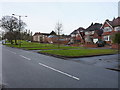
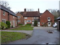
54 photos from this area
Area Information
Key information about the B14 5AN including its size, population, and administrative classification.
- Area Type
- Postcode
- Area Size
- 1.3 hectares
- Population
- 2795
- Population Density
- 4257 people/km²
House Prices in B14 5AN
53
Properties
£195,095
Average Sold Price
£83,000
Lowest Price
£370,000
Highest Price
Showing 53 properties
| Address | Type | Beds | Baths | Last Sale Price | Last Sale Date | |
|---|---|---|---|---|---|---|
| 106 Bayston Road, Birmingham, B14 5AN | house | 3 | 1 | £370,000 | Sep 2024 | |
| 50 Bayston Road, Birmingham, B14 5AN | Terraced | - | - | £150,000 | Mar 2021 | |
| 62 Bayston Road, Birmingham, B14 5AN | Semi-detached | 3 | - | £100,000 | Dec 2020 | |
| 76 Bayston Road, Birmingham, B14 5AN | Bungalow | 2 | - | £83,000 | Nov 2019 | |
| 52 Bayston Road, Birmingham, B14 5AN | Terraced | 4 | 2 | £293,000 | Mar 2018 | |
| 88 Bayston Road, Birmingham, B14 5AN | Semi-detached | 3 | - | £180,000 | Jan 2015 | |
| 92 Bayston Road, Birmingham, B14 5AN | Semi-detached | 3 | - | £187,500 | Nov 2013 | |
| 98 Bayston Road, Birmingham, B14 5AN | house | - | - | £174,950 | Jan 2009 | |
| 58 Bayston Road, Birmingham, B14 5AN | Semi-detached | 5 | 3 | £249,500 | Sep 2007 | |
| 94 Bayston Road, Birmingham, B14 5AN | Terraced | - | - | £163,000 | Sep 2004 |
Page 1 of 6
Energy Efficiency in B14 5AN
Amenities
Schools
| Rank | School | Type | Entry gender | Ages |
|---|
Explore more schools in this area
Go to Schools tabDemographics
Household Size
Family (3-5 people)
most common
Accommodation Type
Houses
most common
Tenure
71
majority
Ethnic Group
White
most common
Religion
N/A
most common
Household Composition
N/A
most common
Age
47
median
Adults (30-64 years)
most common
Household Deprivation
N/A
with no deprivation
NS-SEC
37
in Lower managerial occupations
Explore more demographic insights in this area
Go to Demographics tabPlanning
Planning Constraints
- Flood RiskPremium
- Ramsar Wetland SitesPremium
- Area of Outstanding Natural BeautyPremium
- Protected Nature ReservePremium
- Protected WoodlandPremium