Area Overview for B13 9NS
Photos of B13 9NS
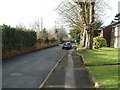
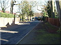
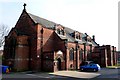
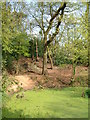
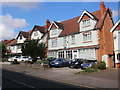
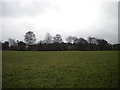
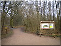
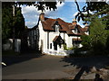
57 photos from this area
Area Information
Key information about the B13 9NS including its size, population, and administrative classification.
- Area Type
- Postcode
- Area Size
- 7446 m²
- Population
- 1763
- Population Density
- 12109 people/km²
House Prices in B13 9NS
39
Properties
£131,394
Average Sold Price
£40,000
Lowest Price
£252,000
Highest Price
Showing 39 properties
| Address | Type | Beds | Baths | Last Sale Price | Last Sale Date | |
|---|---|---|---|---|---|---|
| 36 Dovey Road, Birmingham, B13 9NS | Terraced | 3 | 2 | £190,000 | Aug 2025 | |
| 54 Dovey Road, Birmingham, B13 9NS | Terraced | 4 | 2 | £252,000 | Jul 2025 | |
| 40 Dovey Road, Birmingham, B13 9NS | Terraced | 3 | 1 | £233,500 | May 2025 | |
| 6 Dovey Road, Birmingham, B13 9NS | Terraced | 3 | 2 | £193,000 | Sep 2023 | |
| 56 Dovey Road, Birmingham, B13 9NS | house | - | - | £110,000 | Nov 2021 | |
| 16 Dovey Road, Birmingham, B13 9NS | house | 3 | - | £180,000 | Mar 2021 | |
| 64 Dovey Road, Birmingham, B13 9NS | Terraced | 3 | 2 | £150,000 | Sep 2019 | |
| 2 Dovey Road, Birmingham, B13 9NS | house | - | - | £50,000 | Aug 2018 | |
| 58 Dovey Road, Birmingham, B13 9NS | Terraced | 3 | 2 | £209,950 | Aug 2018 | |
| 12 Dovey Road, Birmingham, B13 9NS | Terraced | 3 | - | £142,000 | Jul 2016 |
Page 1 of 4
Energy Efficiency in B13 9NS
Amenities
Schools
| Rank | School | Type | Entry gender | Ages |
|---|
Explore more schools in this area
Go to Schools tabDemographics
Household Size
Family (3-5 people)
most common
Accommodation Type
Houses
most common
Tenure
64
majority
Ethnic Group
asian_total
most common
Religion
N/A
most common
Household Composition
N/A
most common
Age
22
median
Adults (30-64 years)
most common
Household Deprivation
N/A
with no deprivation
NS-SEC
17
in Lower managerial occupations
Explore more demographic insights in this area
Go to Demographics tabPlanning
Planning Constraints
- Flood RiskPremium
- Ramsar Wetland SitesPremium
- Area of Outstanding Natural BeautyPremium
- Protected Nature ReservePremium
- Protected WoodlandPremium