Area Overview for B13 9NL
Photos of B13 9NL
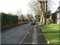
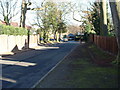
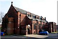
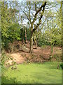
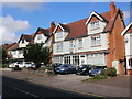
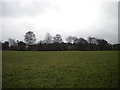
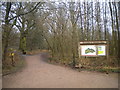
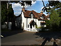
57 photos from this area
Area Information
Key information about the B13 9NL including its size, population, and administrative classification.
- Area Type
- Postcode
- Area Size
- 6864 m²
- Population
- 1763
- Population Density
- 12109 people/km²
House Prices in B13 9NL
20
Properties
£137,450
Average Sold Price
£59,950
Lowest Price
£232,500
Highest Price
Showing 20 properties
| Address | Type | Beds | Baths | Last Sale Price | Last Sale Date | |
|---|---|---|---|---|---|---|
| 11 Penshaw Grove, Birmingham, B13 9NL | Terraced | 3 | 1 | £213,000 | Jul 2025 | |
| 2 Penshaw Grove, Birmingham, B13 9NL | house | 3 | 1 | £232,500 | Sep 2024 | |
| 15 Penshaw Grove, Birmingham, B13 9NL | Terraced | 3 | 1 | £151,000 | Feb 2018 | |
| 20 Penshaw Grove, Birmingham, B13 9NL | Terraced | 3 | 1 | £162,500 | Feb 2018 | |
| 7 Penshaw Grove, Birmingham, B13 9NL | Terraced | 2 | 1 | £145,000 | Sep 2017 | |
| 14 Penshaw Grove, Birmingham, B13 9NL | house | - | - | £120,000 | Aug 2017 | |
| 9 Penshaw Grove, Birmingham, B13 9NL | house | - | - | £101,000 | Jan 2012 | |
| 17 Penshaw Grove, Birmingham, B13 9NL | house | - | - | £115,000 | Nov 2007 | |
| 21 Penshaw Grove, Birmingham, B13 9NL | Terraced | 3 | 1 | £140,000 | Feb 2006 | |
| 12 Penshaw Grove, Birmingham, B13 9NL | house | - | - | £72,000 | Mar 2002 |
Page 1 of 2
Energy Efficiency in B13 9NL
Amenities
Schools
| Rank | School | Type | Entry gender | Ages |
|---|
Explore more schools in this area
Go to Schools tabDemographics
Household Size
Family (3-5 people)
most common
Accommodation Type
Houses
most common
Tenure
64
majority
Ethnic Group
asian_total
most common
Religion
N/A
most common
Household Composition
N/A
most common
Age
22
median
Adults (30-64 years)
most common
Household Deprivation
N/A
with no deprivation
NS-SEC
17
in Lower managerial occupations
Explore more demographic insights in this area
Go to Demographics tabPlanning
Planning Constraints
- Flood RiskPremium
- Ramsar Wetland SitesPremium
- Area of Outstanding Natural BeautyPremium
- Protected Nature ReservePremium
- Protected WoodlandPremium