Area Overview for B13 0SL
Photos of B13 0SL
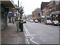
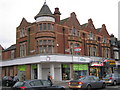
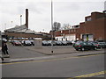
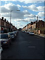
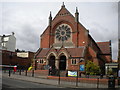

65 photos from this area
Area Information
Key information about the B13 0SL including its size, population, and administrative classification.
- Area Type
- Postcode
- Area Size
- 1.5 hectares
- Population
- Not available
- Population Density
- Not available
House Prices in B13 0SL
24
Properties
£349,542
Average Sold Price
£94,000
Lowest Price
£765,000
Highest Price
Showing 24 properties
| Address | Type | Beds | Baths | Last Sale Price | Last Sale Date | |
|---|---|---|---|---|---|---|
| 16 Portman Road, Birmingham, B13 0SL | Detached | 3 | 1 | £535,000 | Dec 2024 | |
| 54 Portman Road, Birmingham, B13 0SL | Detached | 3 | 2 | £765,000 | Jan 2023 | |
| 40 Portman Road, Birmingham, B13 0SL | house | - | - | £470,000 | Sep 2021 | |
| 10 Portman Road, Birmingham, B13 0SL | Detached | 3 | 1 | £452,000 | Aug 2017 | |
| 22 Portman Road, Birmingham, B13 0SL | house | - | - | £290,000 | May 2014 | |
| 32 Portman Road, Birmingham, B13 0SL | house | - | - | £268,000 | Apr 2009 | |
| 56 Portman Road, Birmingham, B13 0SL | house | - | - | £275,000 | Nov 2008 | |
| 48 Portman Road, Birmingham, B13 0SL | house | - | - | £282,500 | Jul 2006 | |
| 20 Portman Road, Birmingham, B13 0SL | Detached | - | - | £305,000 | Aug 2004 | |
| 50 Portman Road, Birmingham, B13 0SL | Detached | - | - | £263,000 | Apr 2004 |
Page 1 of 3
Energy Efficiency in B13 0SL
Amenities
Schools
| Rank | School | Type | Entry gender | Ages |
|---|
Explore more schools in this area
Go to Schools tabDemographics
Household Size
Family (3-5 people)
most common
Accommodation Type
Houses
most common
Tenure
76
majority
Ethnic Group
White
most common
Religion
N/A
most common
Household Composition
N/A
most common
Age
47
median
Adults (30-64 years)
most common
Household Deprivation
N/A
with no deprivation
NS-SEC
43
in Lower managerial occupations
Explore more demographic insights in this area
Go to Demographics tabPlanning
Planning Constraints
- Flood RiskPremium
- Ramsar Wetland SitesPremium
- Area of Outstanding Natural BeautyPremium
- Protected Nature ReservePremium
- Protected WoodlandPremium