Area Overview for B13 0SH
Photos of B13 0SH
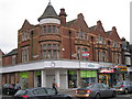
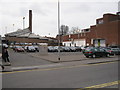
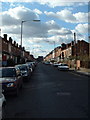
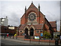

65 photos from this area
Area Information
Key information about the B13 0SH including its size, population, and administrative classification.
- Area Type
- Postcode
- Area Size
- 1.2 hectares
- Population
- Not available
- Population Density
- Not available
House Prices in B13 0SH
20
Properties
£321,305
Average Sold Price
£116,000
Lowest Price
£505,800
Highest Price
Showing 20 properties
| Address | Type | Beds | Baths | Last Sale Price | Last Sale Date | |
|---|---|---|---|---|---|---|
| 37 Portman Road, Birmingham, B13 0SH | Detached | 3 | 1 | £493,670 | Dec 2022 | |
| 1 Portman Road, Birmingham, B13 0SH | Detached | 3 | - | £505,800 | Jan 2022 | |
| 11 Portman Road, Birmingham, B13 0SH | house | - | - | £446,850 | Aug 2021 | |
| 29 Portman Road, Birmingham, B13 0SH | house | 3 | 1 | £373,000 | Aug 2019 | |
| 51 Portman Road, Birmingham, B13 0SH | Detached | 3 | - | £324,000 | Apr 2015 | |
| 25 Portman Road, Birmingham, B13 0SH | house | - | - | £287,000 | Mar 2013 | |
| 17 Portman Road, Birmingham, B13 0SH | Detached | - | - | £330,000 | Jan 2007 | |
| 33 Portman Road, Birmingham, B13 0SH | Detached | - | - | £284,000 | Dec 2006 | |
| 47 Portman Road, Birmingham, B13 0SH | Detached | 4 | 2 | £465,000 | Dec 2006 | |
| 39 Portman Road, Birmingham, B13 0SH | Detached | 4 | 1 | £290,000 | Jun 2004 |
Page 1 of 2
Energy Efficiency in B13 0SH
Amenities
Schools
| Rank | School | Type | Entry gender | Ages |
|---|
Explore more schools in this area
Go to Schools tabDemographics
Household Size
Family (3-5 people)
most common
Accommodation Type
Houses
most common
Tenure
76
majority
Ethnic Group
White
most common
Religion
N/A
most common
Household Composition
N/A
most common
Age
47
median
Adults (30-64 years)
most common
Household Deprivation
N/A
with no deprivation
NS-SEC
43
in Lower managerial occupations
Explore more demographic insights in this area
Go to Demographics tabPlanning
Planning Constraints
- Flood RiskPremium
- Ramsar Wetland SitesPremium
- Area of Outstanding Natural BeautyPremium
- Protected Nature ReservePremium
- Protected WoodlandPremium