Area Overview for B11 4EP
Photos of B11 4EP
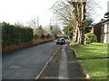
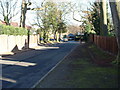
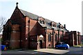
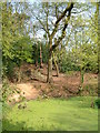
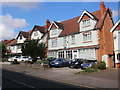
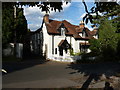
57 photos from this area
Area Information
Key information about the B11 4EP including its size, population, and administrative classification.
- Area Type
- Postcode
- Area Size
- 2.2 hectares
- Population
- 1755
- Population Density
- 6578 people/km²
House Prices in B11 4EP
32
Properties
£291,222
Average Sold Price
£33,000
Lowest Price
£495,000
Highest Price
Showing 32 properties
| Address | Type | Beds | Baths | Last Sale Price | Last Sale Date | |
|---|---|---|---|---|---|---|
| 43 Mackenzie Road, Birmingham, B11 4EP | house | - | - | £269,000 | Dec 2018 | |
| 49 Mackenzie Road, Birmingham, B11 4EP | Semi-detached | - | - | £450,000 | Jun 2017 | |
| 27 Mackenzie Road, Birmingham, B11 4EP | house | 5 | 2 | £421,000 | Oct 2016 | |
| 21 Mackenzie Road, Birmingham, B11 4EP | Detached | 4 | - | £380,000 | Jul 2015 | |
| 7 Mackenzie Road, Birmingham, B11 4EP | house | - | - | £335,000 | Sep 2011 | |
| 59 Mackenzie Road, Birmingham, B11 4EP | Detached | 7 | 2 | £495,000 | Jun 2011 | |
| 57 Mackenzie Road, Birmingham, B11 4EP | house | - | - | £327,000 | May 2009 | |
| 45 Mackenzie Road, Birmingham, B11 4EP | house | - | - | £383,000 | Dec 2007 | |
| 41 Mackenzie Road, Birmingham, B11 4EP | Detached | - | - | £355,000 | Sep 2007 | |
| 5 Mackenzie Road, Birmingham, B11 4EP | Semi-detached | - | - | £380,000 | Jul 2005 |
Page 1 of 4
Energy Efficiency in B11 4EP
Amenities
Schools
| Rank | School | Type | Entry gender | Ages |
|---|
Explore more schools in this area
Go to Schools tabDemographics
Household Size
One person
most common
Accommodation Type
Flats
most common
Tenure
69
majority
Ethnic Group
asian_total
most common
Religion
N/A
most common
Household Composition
N/A
most common
Age
47
median
Adults (30-64 years)
most common
Household Deprivation
N/A
with no deprivation
NS-SEC
38
in Lower managerial occupations
Explore more demographic insights in this area
Go to Demographics tabPlanning
Planning Constraints
- Flood RiskPremium
- Ramsar Wetland SitesPremium
- Area of Outstanding Natural BeautyPremium
- Protected Nature ReservePremium
- Protected WoodlandPremium