Area Overview for B11 4EW
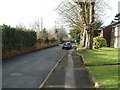
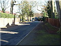
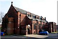
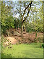
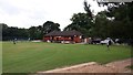
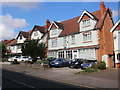
Photos of B11 4EW

Area Information
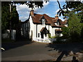
B11 4EW is a small residential cluster in Birmingham’s Sparkhill area, a historically significant part of the city. With a population of 1,755, it reflects the urban character of inner-city Birmingham, shaped by centuries of industrial and migratory influences. Sparkhill’s origins trace back to the Domesday Book, with its name possibly derived from the Sparke family or Spark Brook, a stream that once flowed through the region. The area was annexed by Birmingham in 1911 and saw major redevelopment during the 19th century, creating terraced housing that still defines its layout today. Modern B11 4EW is a hub of cultural diversity, with South Asians forming the predominant ethnic group. The community is largely composed of adults aged 30–64, reflecting a mature demographic profile. Daily life here is punctuated by proximity to retail, rail, and metro networks, making it practical for commuters. The area’s legacy as part of the “Balti Triangle” endures, with South Asian eateries and community hubs adding to its distinct character. Despite its compact size, B11 4EW offers a blend of historical architecture, such as St John’s Church, and contemporary amenities, creating a lived-in feel for residents.
- Area Type
- Postcode
- Area Size
- Not available
- Population
- 1755
- Population Density
- 6578 people/km²
B11 4EW is primarily a home-ownership area, with 69% of properties owned by residents rather than rented. The accommodation type is predominantly flats, reflecting the area’s history of terraced housing and post-war development. This suggests a compact, densely populated layout, typical of inner-city Birmingham. For buyers, the market is limited to a small cluster of properties, with flats forming the bulk of available stock. This may appeal to those seeking affordable, centrally located housing, though the small size of the postcode means the surrounding areas, such as Sparkbrook and Hall Green, are likely to be key for broader property searches. The high home ownership rate indicates a stable market, but buyers should consider the limited availability of detached or semi-detached homes.
House Prices in B11 4EW
No properties found in this postcode.
Energy Efficiency in B11 4EW
Residents of B11 4EW have access to a range of amenities within walking or short driving distance. Retail options include Asda Sparkhill, Co-op Sparkhill, and M&S Moseley, offering everyday shopping needs. The area’s proximity to rail and metro stations enhances its connectivity, with Hall Green, Spring Road, and Tyseley stations providing direct links to Birmingham’s transport network. The local character is enriched by historic sites such as St John’s Church and Sparkhill Library, which date back to the 19th century. The area’s legacy as part of the Balti Triangle means South Asian eateries and community hubs are prominent, adding to the cultural vibrancy. While green spaces are not explicitly mentioned, the historical presence of Spark Brook and nearby parks may offer recreational opportunities. The combination of retail, transport, and cultural amenities makes daily life in B11 4EW both practical and varied.
Amenities
Schools
| Rank | School | Type | Entry gender | Ages |
|---|
Explore more schools in this area
Go to Schools tabDemographics
The population of B11 4EW is 1,755, with a median age of 47, indicating a mature community. The majority of residents are adults aged 30–64, suggesting a stable, established demographic. Home ownership is high at 69%, with flats being the predominant accommodation type. This reflects a mix of long-term residents and those living in purpose-built housing, often in terraced or semi-detached configurations. The area’s ethnic composition is heavily influenced by migration patterns, with South Asians forming the largest group. This diversity is evident in local culture and cuisine, particularly in the nearby Balti Triangle. While specific deprivation data is not provided, the high home ownership rate and low crime score suggest a relatively stable quality of life. The presence of community institutions like Sparkhill Library and historic pubs such as the Mermaid Inn further underscores the area’s social cohesion.
Household Size
Accommodation Type
Tenure
Ethnic Group
Religion
Household Composition
Age
Household Deprivation
NS-SEC
Explore more demographic insights in this area
Go to Demographics tabPlanning
Planning Constraints
- Flood RiskPremium
- Ramsar Wetland SitesPremium
- Area of Outstanding Natural BeautyPremium
- Protected Nature ReservePremium
- Protected WoodlandPremium