Area Overview for B11 4EN
Photos of B11 4EN


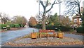
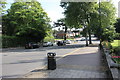
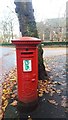
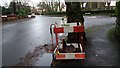
84 photos from this area
Area Information
Key information about the B11 4EN including its size, population, and administrative classification.
- Area Type
- Postcode
- Area Size
- 1.8 hectares
- Population
- 1755
- Population Density
- 6578 people/km²
House Prices in B11 4EN
16
Properties
£254,432
Average Sold Price
£90,000
Lowest Price
£430,000
Highest Price
Showing 16 properties
| Address | Type | Beds | Baths | Last Sale Price | Last Sale Date | |
|---|---|---|---|---|---|---|
| 16 The Vale, Springfield, Birmingham, B11 4EN | house | - | - | £145,000 | Jul 2025 | |
| 9 The Vale, Springfield, Birmingham, B11 4EN | house | 6 | - | £260,000 | Oct 2022 | |
| 19 The Vale, Springfield, Birmingham, B11 4EN | house | - | - | £355,500 | Oct 2020 | |
| 2A The Vale, Springfield, Birmingham, B11 4EN | Bungalow | 3 | 1 | £359,250 | Apr 2017 | |
| 21 The Vale, Springfield, Birmingham, B11 4EN | Bungalow | 2 | - | £280,000 | Jan 2007 | |
| 2 The Vale, Springfield, Birmingham, B11 4EN | Detached | 5 | - | £430,000 | Apr 2006 | |
| 11 The Vale, Springfield, Birmingham, B11 4EN | Detached | 4 | - | £315,000 | Jan 2005 | |
| 10 The Vale, Springfield, Birmingham, B11 4EN | Detached | 4 | 3 | £290,000 | May 2004 | |
| 12 The Vale, Springfield, Birmingham, B11 4EN | Detached | - | - | £155,000 | Sep 1999 | |
| 7 The Vale, Springfield, Birmingham, B11 4EN | Detached | - | - | £90,000 | Aug 1999 |
Page 1 of 2
Energy Efficiency in B11 4EN
Amenities
Schools
| Rank | School | Type | Entry gender | Ages |
|---|
Explore more schools in this area
Go to Schools tabDemographics
Household Size
One person
most common
Accommodation Type
Flats
most common
Tenure
69
majority
Ethnic Group
asian_total
most common
Religion
N/A
most common
Household Composition
N/A
most common
Age
47
median
Adults (30-64 years)
most common
Household Deprivation
N/A
with no deprivation
NS-SEC
38
in Lower managerial occupations
Explore more demographic insights in this area
Go to Demographics tabPlanning
Planning Constraints
- Flood RiskPremium
- Ramsar Wetland SitesPremium
- Area of Outstanding Natural BeautyPremium
- Protected Nature ReservePremium
- Protected WoodlandPremium