Area Overview for B11 4EH
Photos of B11 4EH


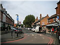
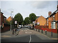
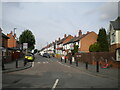
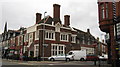
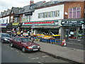
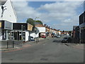
50 photos from this area
Area Information
Key information about the B11 4EH including its size, population, and administrative classification.
- Area Type
- Postcode
- Area Size
- 1.2 hectares
- Population
- 1755
- Population Density
- 6578 people/km²
House Prices in B11 4EH
19
Properties
£216,572
Average Sold Price
£65,005
Lowest Price
£650,000
Highest Price
Showing 19 properties
| Address | Type | Beds | Baths | Last Sale Price | Last Sale Date | |
|---|---|---|---|---|---|---|
| 31 Woodlands Road, Springfield, Birmingham, B11 4EH | house | 4 | - | £300,000 | Sep 2021 | |
| 37 Woodlands Road, Springfield, Birmingham, B11 4EH | Semi-detached | 5 | 3 | £153,000 | Nov 2018 | |
| 21 Woodlands Road, Springfield, Birmingham, B11 4EH | house | - | - | £175,000 | Mar 2017 | |
| 27 Woodlands Road, Springfield, Birmingham, B11 4EH | Detached | 3 | 2 | £275,000 | Mar 2016 | |
| 53 Woodlands Road, Springfield, Birmingham, B11 4EH | Semi-detached | 3 | - | £202,000 | Jan 2016 | |
| 9 Woodlands Road, Springfield, Birmingham, B11 4EH | house | 5 | - | £212,000 | Jun 2012 | |
| 15 Woodlands Road, Springfield, Birmingham, B11 4EH | house | 7 | 3 | £650,000 | Nov 2006 | |
| 19 Woodlands Road, Springfield, Birmingham, B11 4EH | house | - | - | £295,000 | Oct 2006 | |
| 7 Woodlands Road, Springfield, Birmingham, B11 4EH | house | 5 | - | £249,999 | May 2006 | |
| 51 Woodlands Road, Springfield, Birmingham, B11 4EH | Semi-detached | 6 | 3 | £127,000 | Jul 1999 |
Page 1 of 2
Energy Efficiency in B11 4EH
Amenities
Schools
| Rank | School | Type | Entry gender | Ages |
|---|
Explore more schools in this area
Go to Schools tabDemographics
Household Size
One person
most common
Accommodation Type
Flats
most common
Tenure
69
majority
Ethnic Group
asian_total
most common
Religion
N/A
most common
Household Composition
N/A
most common
Age
47
median
Adults (30-64 years)
most common
Household Deprivation
N/A
with no deprivation
NS-SEC
38
in Lower managerial occupations
Explore more demographic insights in this area
Go to Demographics tabPlanning
Planning Constraints
- Flood RiskPremium
- Ramsar Wetland SitesPremium
- Area of Outstanding Natural BeautyPremium
- Protected Nature ReservePremium
- Protected WoodlandPremium