Area Overview for B11 3LU
Photos of B11 3LU
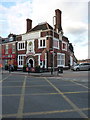

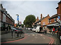
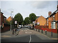
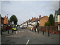
50 photos from this area
Area Information
Key information about the B11 3LU including its size, population, and administrative classification.
- Area Type
- Postcode
- Area Size
- 1.1 hectares
- Population
- 3307
- Population Density
- 14903 people/km²
House Prices in B11 3LU
56
Properties
£83,921
Average Sold Price
£27,000
Lowest Price
£170,000
Highest Price
Showing 56 properties
| Address | Type | Beds | Baths | Last Sale Price | Last Sale Date | |
|---|---|---|---|---|---|---|
| 3 Sadler Crescent, Birmingham, B11 3LU | house | - | - | £152,000 | Nov 2024 | |
| 9 Sadler Crescent, Birmingham, B11 3LU | Terraced | 2 | - | £94,421 | Jul 2019 | |
| 74 Lea Road, Birmingham, B11 3LU | house | - | - | £170,000 | Jun 2019 | |
| 6 Sadler Crescent, Birmingham, B11 3LU | house | 2 | - | £89,500 | Jan 2019 | |
| 16 Lea Road, Birmingham, B11 3LU | Semi-detached | - | - | £60,000 | Feb 2018 | |
| 10 Lea Road, Birmingham, B11 3LU | Terraced | 3 | 1 | £80,000 | Aug 2015 | |
| 18 Lea Road, Birmingham, B11 3LU | house | - | - | £68,000 | Apr 2015 | |
| 7 Sadler Crescent, Birmingham, B11 3LU | Terraced | 2 | 1 | £65,000 | Nov 2012 | |
| 8 Sadler Crescent, Birmingham, B11 3LU | Terraced | 2 | - | £66,000 | Nov 2012 | |
| 50 Lea Road, Birmingham, B11 3LU | house | - | - | £81,500 | May 2012 |
Page 1 of 6
Energy Efficiency in B11 3LU
Amenities
Schools
| Rank | School | Type | Entry gender | Ages |
|---|
Explore more schools in this area
Go to Schools tabDemographics
Household Size
Family (3-5 people)
most common
Accommodation Type
Houses
most common
Tenure
50
majority
Ethnic Group
asian_total
most common
Religion
N/A
most common
Household Composition
N/A
most common
Age
22
median
Adults (30-64 years)
most common
Household Deprivation
N/A
with no deprivation
NS-SEC
9
in Lower managerial occupations
Explore more demographic insights in this area
Go to Demographics tabPlanning
Planning Constraints
- Flood RiskPremium
- Ramsar Wetland SitesPremium
- Area of Outstanding Natural BeautyPremium
- Protected Nature ReservePremium
- Protected WoodlandPremium