Area Overview for B10 9NR
Photos of B10 9NR
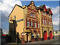
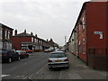
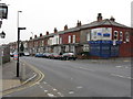
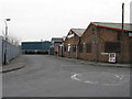
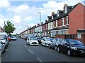
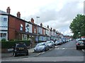
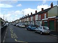
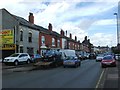
57 photos from this area
Area Information
Key information about the B10 9NR including its size, population, and administrative classification.
- Area Type
- Postcode
- Area Size
- 5348 m²
- Population
- 2419
- Population Density
- 18508 people/km²
House Prices in B10 9NR
31
Properties
£99,813
Average Sold Price
£24,500
Lowest Price
£220,000
Highest Price
Showing 31 properties
| Address | Type | Beds | Baths | Last Sale Price | Last Sale Date | |
|---|---|---|---|---|---|---|
| 59 Mansel Road, Birmingham, B10 9NR | Terraced | 3 | - | £220,000 | May 2023 | |
| 49 Mansel Road, Birmingham, B10 9NR | Terraced | 3 | 1 | £170,000 | Feb 2022 | |
| 47 Mansel Road, Birmingham, B10 9NR | house | - | - | £165,000 | Nov 2021 | |
| 55 Mansel Road, Birmingham, B10 9NR | house | 3 | - | £164,000 | Jun 2021 | |
| 57 Mansel Road, Birmingham, B10 9NR | house | - | - | £145,000 | Jan 2021 | |
| 73 Mansel Road, Birmingham, B10 9NR | house | - | - | £80,000 | May 2013 | |
| 75 Mansel Road, Birmingham, B10 9NR | house | - | - | £120,000 | Dec 2006 | |
| 79 Mansel Road, Birmingham, B10 9NR | Terraced | 3 | 1 | £132,000 | Oct 2006 | |
| 53 Mansel Road, Birmingham, B10 9NR | Terraced | - | - | £115,000 | May 2006 | |
| 95 Mansel Road, Birmingham, B10 9NR | house | - | - | £94,000 | Feb 2006 |
Page 1 of 4
Energy Efficiency in B10 9NR
Amenities
Schools
| Rank | School | Type | Entry gender | Ages |
|---|
Explore more schools in this area
Go to Schools tabDemographics
Household Size
Family (3-5 people)
most common
Accommodation Type
Houses
most common
Tenure
73
majority
Ethnic Group
asian_total
most common
Religion
N/A
most common
Household Composition
N/A
most common
Age
22
median
Adults (30-64 years)
most common
Household Deprivation
N/A
with no deprivation
NS-SEC
11
in Lower managerial occupations
Explore more demographic insights in this area
Go to Demographics tabPlanning
Planning Constraints
- Flood RiskPremium
- Ramsar Wetland SitesPremium
- Area of Outstanding Natural BeautyPremium
- Protected Nature ReservePremium
- Protected WoodlandPremium