Area Overview for B10 9LZ
Photos of B10 9LZ
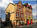
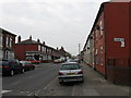
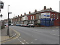
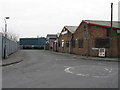
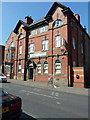
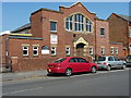
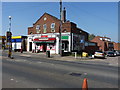
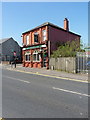
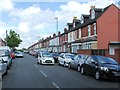
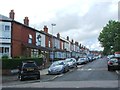
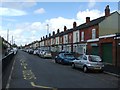
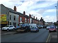
57 photos from this area
Area Information
Key information about the B10 9LZ including its size, population, and administrative classification.
- Area Type
- Postcode
- Area Size
- 3461 m²
- Population
- 2419
- Population Density
- 18508 people/km²
House Prices in B10 9LZ
18
Properties
£97,833
Average Sold Price
£32,000
Lowest Price
£200,000
Highest Price
Showing 18 properties
| Address | Type | Beds | Baths | Last Sale Price | Last Sale Date | |
|---|---|---|---|---|---|---|
| 94 Mansel Road, Birmingham, B10 9LZ | Terraced | 4 | 1 | £171,500 | Jan 2025 | |
| 78 Mansel Road, Birmingham, B10 9LZ | house | - | - | £185,000 | Sep 2022 | |
| 86 Mansel Road, Birmingham, B10 9LZ | house | - | - | £128,000 | Nov 2006 | |
| 102 Mansel Road, Birmingham, B10 9LZ | house | - | - | £200,000 | May 2004 | |
| 74 Mansel Road, Birmingham, B10 9LZ | Terraced | 3 | 1 | £50,000 | Oct 2001 | |
| 80 Mansel Road, Birmingham, B10 9LZ | house | - | - | £36,500 | Jul 1999 | |
| 90 Mansel Road, Birmingham, B10 9LZ | house | - | - | £40,500 | Nov 1998 | |
| 72 Mansel Road, Birmingham, B10 9LZ | house | - | - | £37,000 | Nov 1998 | |
| 100 Mansel Road, Birmingham, B10 9LZ | house | - | - | £32,000 | May 1995 | |
| 70 Mansel Road, Birmingham, B10 9LZ | Terraced | 3 | 1 | - | - |
Page 1 of 2
Energy Efficiency in B10 9LZ
Amenities
Schools
| Rank | School | Type | Entry gender | Ages |
|---|
Explore more schools in this area
Go to Schools tabDemographics
Household Size
Family (3-5 people)
most common
Accommodation Type
Houses
most common
Tenure
73
majority
Ethnic Group
asian_total
most common
Religion
N/A
most common
Household Composition
N/A
most common
Age
22
median
Adults (30-64 years)
most common
Household Deprivation
N/A
with no deprivation
NS-SEC
11
in Lower managerial occupations
Explore more demographic insights in this area
Go to Demographics tabPlanning
Planning Constraints
- Flood RiskPremium
- Ramsar Wetland SitesPremium
- Area of Outstanding Natural BeautyPremium
- Protected Nature ReservePremium
- Protected WoodlandPremium