Area Overview for B10 0EB
Photos of B10 0EB
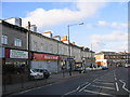
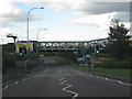

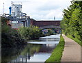
100 photos from this area
Area Information
Key information about the B10 0EB including its size, population, and administrative classification.
- Area Type
- Postcode
- Area Size
- 7397 m²
- Population
- 1899
- Population Density
- 5465 people/km²
House Prices in B10 0EB
26
Properties
£99,890
Average Sold Price
£38,000
Lowest Price
£200,000
Highest Price
Showing 26 properties
| Address | Type | Beds | Baths | Last Sale Price | Last Sale Date | |
|---|---|---|---|---|---|---|
| 7 Bassett Croft, Birmingham, B10 0EB | Terraced | 4 | 1 | £200,000 | Jan 2025 | |
| 32 Bassett Croft, Birmingham, B10 0EB | house | - | - | £82,500 | Nov 2013 | |
| 26 Bassett Croft, Birmingham, B10 0EB | house | - | - | £126,500 | Mar 2008 | |
| 24 Bassett Croft, Birmingham, B10 0EB | Terraced | 4 | 1 | £147,000 | Nov 2007 | |
| 1 Bassett Croft, Birmingham, B10 0EB | Terraced | 4 | 1 | £149,950 | Feb 2007 | |
| 36 Bassett Croft, Birmingham, B10 0EB | house | - | - | £93,500 | Sep 2005 | |
| 28 Bassett Croft, Birmingham, B10 0EB | Terraced | - | - | £78,000 | May 2003 | |
| 17 Bassett Croft, Birmingham, B10 0EB | Terraced | 3 | - | £41,500 | Nov 2000 | |
| 29 Bassett Croft, Birmingham, B10 0EB | house | - | - | £38,000 | Apr 1999 | |
| 15 Bassett Croft, Birmingham, B10 0EB | Terraced | - | - | £41,950 | Jan 1997 |
Page 1 of 3
Energy Efficiency in B10 0EB
Amenities
Schools
| Rank | School | Type | Entry gender | Ages |
|---|
Explore more schools in this area
Go to Schools tabDemographics
Household Size
One person
most common
Accommodation Type
Houses
most common
Tenure
28
majority
Ethnic Group
asian_total
most common
Religion
N/A
most common
Household Composition
N/A
most common
Age
47
median
Adults (30-64 years)
most common
Household Deprivation
N/A
with no deprivation
NS-SEC
7
in Lower managerial occupations
Explore more demographic insights in this area
Go to Demographics tabPlanning
Planning Constraints
- Flood RiskPremium
- Ramsar Wetland SitesPremium
- Area of Outstanding Natural BeautyPremium
- Protected Nature ReservePremium
- Protected WoodlandPremium