Area Overview for B10 0NB
Photos of B10 0NB
Area Information
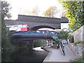
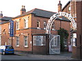
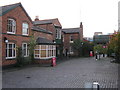
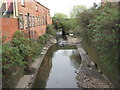
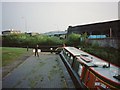
B10 0NB is a small residential postcode area in Birmingham, England, with a population of 1,899. Situated about two miles east of the city centre, it lies within the West Midlands region and is centred around coordinates 52.470013, -1.872136. The area has a distinct historical character, shaped by early 20th-century development and wartime activity. Notably, it includes the Ideal Village, a pioneering housing project from 1908–1914 designed by Barry Parker and Raymond Unwin, featuring low-density homes, a park, and a school. The area’s history includes Blitz raids during World War II and the presence of HANDEL nuclear warning equipment in the 1960s. Today, B10 0NB is a compact, mixed-use neighbourhood with a focus on local amenities and transport links. Its residents benefit from proximity to retail, rail, and metro services, while the area’s small size fosters a tight-knit community. The postcode’s demographic profile—skewed towards adults aged 30–64 and with a significant Asian population—reflects a mature, diverse community. For homebuyers, the area offers a blend of historical charm and modern convenience, though its small footprint means properties are limited and often in high demand.
- Area Type
- Postcode
- Area Size
- Not available
- Population
- 1899
- Population Density
- 5465 people/km²
The property market in B10 0NB is characterised by a low home ownership rate of 28%, which suggests that the area is primarily a rental market rather than one dominated by owner-occupied homes. The predominant accommodation type is houses, which is notable for an inner-city postcode, as flats are more common in such areas. This mix of housing stock may appeal to families or individuals seeking more space than typical urban dwellings offer. However, the small size of the postcode means that the housing stock is limited, and properties are likely to be in high demand. For buyers, this could mean competition for available homes and potentially higher prices. The presence of houses may also indicate a focus on long-term stability, as owner-occupied properties are often more common in suburban or semi-rural areas. Given the area’s proximity to transport links and amenities, it could be an attractive option for those seeking a balance between urban convenience and a more spacious living environment.
House Prices in B10 0NB
No properties found in this postcode.
Energy Efficiency in B10 0NB
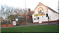
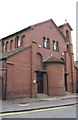
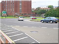
The lifestyle in B10 0NB is shaped by its proximity to a variety of amenities within practical reach. Retail options include Iceland Birmingham, Morrisons Bordesley, and Spar City, offering everyday shopping needs. The area’s transport links are robust, with rail stations like Bordesley Railway Station and metro stops such as Corporation Street providing easy access to Birmingham’s business districts and beyond. The Ideal Village, a historic development, features parks and community projects like St Paul’s Church, adding to the area’s character. These amenities contribute to a balanced lifestyle, blending urban convenience with green spaces and social hubs. The presence of multiple schools, including a primary school with a good Ofsted rating, supports families seeking quality education. While the area is small, its mix of retail, transport, and community spaces ensures that daily life is both functional and engaging for residents.
Amenities
Schools
Residents of B10 0NB have access to a range of educational institutions, including Regents Park Community Primary School, which is a primary school with a good Ofsted rating. For independent education, Eden School of Accountancy and Oakwood School (BIETTEC) are available, though neither specifies an Ofsted rating. Green Heath School, another independent institution, also holds a good Ofsted rating. Blue River Academy is a special school, catering to students with specific educational needs. The mix of school types provides families with options, from state-funded primary education to independent and specialist institutions. The presence of a well-rated primary school may be a significant draw for families prioritising early education, while independent schools offer alternative pathways. However, the lack of Ofsted ratings for some institutions may raise questions about their quality or oversight. Overall, the area offers a varied educational landscape, though parents should investigate further into the specific offerings of each school.
| Rank | School | Type | Entry gender | Ages |
|---|
Explore more schools in this area
Go to Schools tabDemographics
The population of B10 0NB is 1,899, with a median age of 47, indicating a community skewed towards middle-aged adults. The most common age range is 30–64 years, suggesting a stable, working-age population. Home ownership in the area is relatively low at 28%, implying that a majority of residents rent their homes. The predominant accommodation type is houses, which is unusual for inner-city areas, hinting at a mix of older properties and possibly some newer developments. The predominant ethnic group is Asian, reflecting the area’s cultural diversity. This demographic profile suggests a community with established residents who may have lived in the area for many years. The low home ownership rate could indicate economic factors such as higher rental costs or a preference for renting in a dynamic urban environment. For residents, this translates to a neighbourhood with a strong sense of continuity but also one where housing availability might be limited by the small area’s size.
Household Size
Accommodation Type
Tenure
Ethnic Group
Religion
Household Composition
Age
Household Deprivation
NS-SEC
Explore more demographic insights in this area
Go to Demographics tabPlanning
Planning Constraints
- Flood RiskPremium
- Ramsar Wetland SitesPremium
- Area of Outstanding Natural BeautyPremium
- Protected Nature ReservePremium
- Protected WoodlandPremium