Area Overview for PL13 2JR
Photos of PL13 2JR


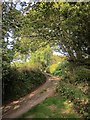
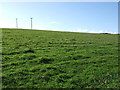
28 photos from this area
Area Information
Key information about the PL13 2JR including its size, population, and administrative classification.
- Area Type
- Postcode
- Area Size
- 94.4 hectares
- Population
- 1201
- Population Density
- 166 people/km²
House Prices in PL13 2JR
36
Properties
£477,333
Average Sold Price
£87,000
Lowest Price
£1,075,000
Highest Price
Showing 36 properties
| Address | Type | Beds | Baths | Last Sale Price | Last Sale Date | |
|---|---|---|---|---|---|---|
| Waylands East, Polperro Road, West Looe, PL13 2JR | house | - | - | £1,075,000 | Jun 2021 | |
| Tencreek Cottage, Polperro Road, West Looe, PL13 2JR | house | - | - | £270,000 | May 2002 | |
| Trejane, Polperro Road, West Looe, PL13 2JR | Retail | 5 | 5 | £87,000 | Dec 1997 | |
| The Workshop, Tencreek Farm, Polperro Road, West Looe, PL13 2JR | Detached | 1 | 1 | - | - | |
| Walden, Polperro Road, West Looe, PL13 2JR | Detached | 4 | 1 | - | - | |
| Tencreek, Polperro Road, West Looe, PL13 2JR | Detached | - | - | - | - | |
| Tencreek Farm, Polperro Road, West Looe, PL13 2JR | house | - | - | - | - | |
| Tencreek House, Polperro Road, West Looe, PL13 2JR | Detached | - | - | - | - | |
| 1, Midwayland, Polperro Road, West Looe, PL13 2JR | Semi-detached | - | - | - | - | |
| Round House, Tencreek, Polperro Road, West Looe, PL13 2JR | house | 1 | 1 | - | - |
Page 1 of 4
Energy Efficiency in PL13 2JR
Amenities
Schools
| Rank | School | Type | Entry gender | Ages |
|---|
Explore more schools in this area
Go to Schools tabDemographics
Household Size
Two person
most common
Accommodation Type
Houses
most common
Tenure
75
majority
Ethnic Group
White
most common
Religion
N/A
most common
Household Composition
N/A
most common
Age
47
median
Adults (30-64 years)
most common
Household Deprivation
N/A
with no deprivation
NS-SEC
31
in Lower managerial occupations
Explore more demographic insights in this area
Go to Demographics tabPlanning
Planning Constraints
- Flood RiskPremium
- Ramsar Wetland SitesPremium
- Area of Outstanding Natural BeautyPremium
- Protected Nature ReservePremium
- Protected WoodlandPremium