Area Overview for PL13 2NF
Photos of PL13 2NF


Area Information
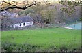
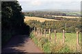
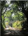
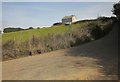
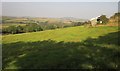
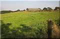
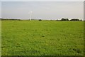
Living in PL13 2NF means residing within a compact residential cluster of 38.8 hectares. This specific postcode area holds a population of 1,201 people, creating a low-density environment with 166 residents per square kilometre. The setting is defined by its proximity to Polperro, offering a quiet domestic experience for those seeking space without urban congestion. You can expect a neighbourhood where homes sit closer to open land rather than neighbouring structures, fostering a sense of privacy. The area functions as a residential extension to the coastal community of Polperro, providing access to the wider amenities of the area while maintaining a distinct, smaller scale. Daily life here revolves around a slower pace, with residents largely integrated into the local village fabric. The small footprint of the postcode ensures that sections are easily navigable, yet the low population density prevents the feeling of crowding that often plagues larger urban clusters. For a homebuyer, this translates to a lifestyle characterised by green spaces and a lack of noise pollution, though it also means the lack of large communal facilities within the immediate perimeter of your address.
- Area Type
- Postcode
- Area Size
- 38.8 hectares
- Population
- 1201
- Population Density
- 166 people/km²
The housing stock in PL13 2NF is characterised by a strong existing base of owner-occupied properties. With 75% of homes owned by their residents, the area trades far more as a market for sellers than a rental market. This high ownership rate typically indicates that properties have been held for significant periods, offering buyers the chance to purchase from owners with a clear history of maintenance. The predominant accommodation type is houses, which means you will find standalone or semi-detached family homes rather than blocks of flats or shared houses. Because the total population is only 1,201 within a 38.8-hectare perimeter, the inventory of homes for sale will remain limited compared to larger towns like Looe or Cunningham. This scarcity often drives prices in this specific postcode to reflect the high demand for housing in Polperro while maintaining a smaller, more curated selection. Buyers should expect to compete against existing owners who may have lived there for decades, rather than facing a large pool of new tenants or developers flipping units.
House Prices in PL13 2NF
Showing 4 properties
| Address | Type | Beds | Baths | Last Sale Price | Last Sale Date | |
|---|---|---|---|---|---|---|
| Wereham Cottage, Parkers Cross, Looe, PL13 2NF | Bungalow | 4 | 2 | £660,000 | Dec 2024 | |
| Grasmere, Parkers Cross, Looe, PL13 2NF | Detached | 4 | 2 | - | - | |
| Pearscot, Parkers Cross, Looe, PL13 2NF | house | - | - | - | - | |
| Hilquite, Parkers Cross, Looe, PL13 2NF | Detached | - | - | - | - |
Energy Efficiency in PL13 2NF
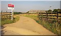
Residents of PL13 2NF enjoy easy access to practical amenities within a short drive or walk. There are five key retail locations nearby, including Spar, Co-op East, and Co-op Looe. These supermarkets provide essential groceries and daily necessities without requiring a trip to a major city. Transport links are equally accessible, with five nearby railway stations including Looe Railway Station, Sandplace Railway Station, and Causeland Railway Station. Although no train station sits directly within the 38.8-hectare perimeter, the proximity to Looe allows commuters to access the wider Cornwall rail network. The concentration of these specific shops and stations ensures that practical daily tasks are manageable, even if the immediate postal area lacks its own shops or leisure centres. The lifestyle is defined by convenience through proximity to the village of Looe and the surrounding hamlets rather than self-containment within the postcode limit. You will not find cinemas or large shopping centres here, but your five nearest supermarkets and five rail stations cover the fundamental requirements of modern living in this rural setting.
Amenities
Schools
Families living in PL13 2NF have two primary options for primary education in their immediate vicinity. The nearest institutions are Polperro Community Primary School and Polperro Primary Academy, both situated within a short distance of the postcode. These schools serve as the main educational hubs for children in the local catchment area. While specific Ofsted ratings are not listed in the available details for these specific institutions, their presence confirms that the area is directly zoned for quality primary education without needing to travel far into Polperro town centre. The concentration of two primary academies suggests a robust local infrastructure for young learners, providing parents with a choice of settings within the village. There are no secondary schools listed specifically for PL13 2NF, meaning older children will likely need to commute to larger hubs such as Polperro, Tredarville, or Instow for upper primary or secondary education. For parents, this setup means early years education is highly accessible within the local cluster of residential homes.
| Rank | School | Type | Entry gender | Ages |
|---|
Explore more schools in this area
Go to Schools tabDemographics
The community within PL13 2NF reflects an established settlement with a median age of 47 years. Most residents fall into the adult age range between 30 and 64 years, indicating a population composed of families and long-term employees rather than students or retirees. This age profile suggests a stable community where families have likely settled for the duration of their working lives. Home ownership stands at a high 75% of households, signalling that the majority of residents bought their properties rather than renting them. The predominant accommodation type consists of houses, which aligns with the owner-occupied nature of the neighbourhood and the preference for larger family dwellings over flats or terraced units. The ethnic composition is predominantly White, mirroring the traditional demographic makeup of coastal villages in this region. There is no significant deprivation present in this specific cluster, as the age and property ownership figures suggest a community with solid financial standing. You are looking at an area where children have grown up, careers have progressed, and families have put down deep roots in the locality.
Household Size
Accommodation Type
Tenure
Ethnic Group
Religion
Household Composition
Age
Household Deprivation
NS-SEC
Explore more demographic insights in this area
Go to Demographics tabPlanning
Planning Constraints
- Flood RiskPremium
- Ramsar Wetland SitesPremium
- Area of Outstanding Natural BeautyPremium
- Protected Nature ReservePremium
- Protected WoodlandPremium