Area Overview for PL13 2JN
Photos of PL13 2JN


Area Information
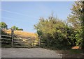
Postcode PL13 2JN represents a compact residential cluster covering 17.1 hectares in Cornwall. This specific address serves a small population of 1,201 people, resulting in a low density of 166 people per square kilometre. The setting reflects a quiet, rural character typical of the wider Looe and Polperro region. Living in PL13 2JN means accepting a close-knit community where neighbours know each other well due to the limited number of households. The area size restricts development potential, preserving the open feel of the landscape. Residents enjoy extensive contact with the open countryside, with no large urban blocks nearby. The low population density ensures that daily life is generally peaceful and free from the noise of major traffic corridors. You will find this postcode distinct from larger towns, offering a retreat suited for those who value space and natural surroundings over urban convenience. The housing stock here caters to established families and individuals seeking stability rather than high-paced city living.
- Area Type
- Postcode
- Area Size
- 17.1 hectares
- Population
- 1201
- Population Density
- 166 people/km²
The property market in PL13 2JN is defined by a strong presence of owner-occupied homes. With 75 per cent of residents owning their homes, the area functions as a stable residential zone rather than a transient rental market. Houses dominate the accommodation type, meaning most properties are detached, semi-detached, or terraced family dwellings rather than flats or purpose-built apartments. This concentration of houses suggests a diverse range of bedroom counts and garden sizes, catering to families seeking long-term stability. For buyers looking at homes in PL13 2JN, expect to find established properties that have been maintained by generations of owners. The total area size of 17.1 hectares limits the volume of available properties, making quality homes in this specific postcode a competitive purchase. You should research privately owned estates and previous sales data to understand the full scope of the local housing stock. The market reflects a community where selling a home often involves moving within a familiar circle of neighbours.
House Prices in PL13 2JN
Showing 8 properties
Energy Efficiency in PL13 2JN
Life in PL13 2JN places you within practical reach of essential amenities and transport links despite the rural setting. You have access to five retail outlets nearby, including two Spar stores and one Co-op East branch. These convenience stores allow you to complete daily shopping tasks without travelling far into larger towns. Four railway stations lie close by, specifically Looe Railway Station, Sandplace Railway Station, and Causeland Railway Station. You can access these stations to travel further along the Cornish coast or to nearby hubs. Additionally, three ferry landing points are within reach, identified as Bodinnick Ferry Landing, Fowey Custom House Quay Ferry Landing, and Fowey Town Quay Ferry Landing. These water crossings offer routes to Fowey and other nearby coastal communities. You will find that the combination of rail and ferry options provides flexible travel choices for weekends or business trips. The nearby amenities ensure that you do not need to commit to long drives for groceries or public transport, keeping daily life convenient. This balance of rural living and accessible links defines the lifestyle here.
Amenities
Schools
Families residing in PL13 2JN have access to two primary schools named in the immediate vicinity. Polperro Community Primary School serves as a local educational option for younger children and early years students. Polperro Primary Academy offers another primary education setting within practical commuting distance for families living near these postcodes. Both institutions are primary schools rather than secondary institutions or academies with sixth form provisions. The presence of two primary choices indicates that families in this area prioritise early education close to home. You will need to check current Ofsted ratings for both Polperro Community Primary School and Polperro Primary Academy on the Department for Education website, as these details are not listed in the provided data. The school mix means that children in PL13 2JN generally attend primary education locally before potentially transferring to secondary schools elsewhere. This setup supports a stable community where children can attend the same school for many years.
| Rank | School | Type | Entry gender | Ages |
|---|
Explore more schools in this area
Go to Schools tabDemographics
The community within PL13 2JN reflects a settled population with a median age of 47 years. Adults between 30 and 64 years represent the most common age range, confirming that this is a family-oriented neighbourhood rather than a retirement or student zone. Home ownership stands at 75 per cent, indicating strong financial stability among residents and a long-term commitment to the area. The majority of the accommodation consists of houses, aligning with the family-focused demographic profile of the catchment. There is a significant degree of wealth within the local household structure, supporting the high ownership rate and stable age group. You will find predominantly white South Asian, Black African, or Black British residents make up the most common ethnic groups in this specificpostcode. The housing stock is almost entirely owner-occupied, with very few private rental properties available for short-term tenancies. This stability creates a predictable environment where neighbours remain in the same homes for many years.
Household Size
Accommodation Type
Tenure
Ethnic Group
Religion
Household Composition
Age
Household Deprivation
NS-SEC
Explore more demographic insights in this area
Go to Demographics tabPlanning
Planning Constraints
- Flood RiskPremium
- Ramsar Wetland SitesPremium
- Area of Outstanding Natural BeautyPremium
- Protected Nature ReservePremium
- Protected WoodlandPremium