Area Overview for DT6 6NF
Photos of DT6 6NF
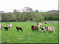
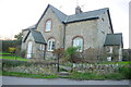
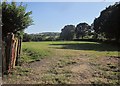
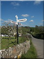
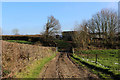
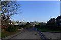
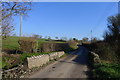
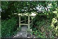
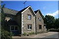
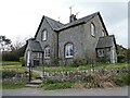
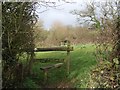
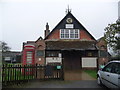
21 photos from this area
Area Information
Key information about the DT6 6NF including its size, population, and administrative classification.
- Area Type
- Postcode
- Area Size
- 5.1 hectares
- Population
- 1690
- Population Density
- 98 people/km²
House Prices in DT6 6NF
12
Properties
£434,250
Average Sold Price
£260,000
Lowest Price
£577,500
Highest Price
Showing 12 properties
| Address | Type | Beds | Baths | Last Sale Price | Last Sale Date | |
|---|---|---|---|---|---|---|
| Foxglove Cottage, School Lane, Wootton Fitzpaine, DT6 6NF | Bungalow | 2 | 2 | £577,500 | Sep 2022 | |
| Meadow Lodge, School Lane, Wootton Fitzpaine, DT6 6NF | Detached | 4 | 2 | £550,000 | Sep 2020 | |
| 2 School Lane, Wootton Fitzpaine, DT6 6NF | house | - | - | £570,000 | Jul 2020 | |
| The Old Coach House, School Lane, Wootton Fitzpaine, DT6 6NF | house | - | - | £575,000 | Jun 2016 | |
| The Old School, School Lane, Wootton Fitzpaine, DT6 6NF | Detached | 4 | 2 | £535,000 | Dec 2015 | |
| Wood Lark, School Lane, Wootton Fitzpaine, DT6 6NF | Bungalow | - | - | £270,000 | May 2007 | |
| Rosemead, School Lane, Wootton Fitzpaine, DT6 6NF | Detached | - | - | £260,000 | Apr 2006 | |
| La Haye Cottage, School Lane, Wootton Fitzpaine, DT6 6NF | Detached | 3 | 2 | £395,000 | Jun 2005 | |
| The Gables, School Lane, Wootton Fitzpaine, DT6 6NF | Detached | 4 | 2 | £345,000 | Apr 2004 | |
| Pastures, School Lane, Wootton Fitzpaine, DT6 6NF | Detached | - | - | £265,000 | Jan 2004 |
Page 1 of 2
Energy Efficiency in DT6 6NF
Amenities
Schools
| Rank | School | Type | Entry gender | Ages |
|---|
Explore more schools in this area
Go to Schools tabDemographics
Household Size
Two person
most common
Accommodation Type
Houses
most common
Tenure
73
majority
Ethnic Group
White
most common
Religion
N/A
most common
Household Composition
N/A
most common
Age
47
median
Elderly (65+ years)
most common
Household Deprivation
N/A
with no deprivation
NS-SEC
36
in Lower managerial occupations
Explore more demographic insights in this area
Go to Demographics tabPlanning
Planning Constraints
- Flood RiskPremium
- Ramsar Wetland SitesPremium
- Area of Outstanding Natural BeautyPremium
- Protected Nature ReservePremium
- Protected WoodlandPremium