Area Overview for DT6 6ND
Photos of DT6 6ND
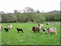
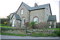
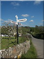
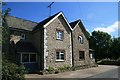
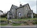
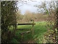
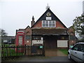
21 photos from this area
Area Information
Key information about the DT6 6ND including its size, population, and administrative classification.
- Area Type
- Postcode
- Area Size
- 1.3 hectares
- Population
- 1690
- Population Density
- 98 people/km²
House Prices in DT6 6ND
4
Properties
£300,000
Average Sold Price
£300,000
Lowest Price
£300,000
Highest Price
Showing 4 properties
| Address | Type | Beds | Baths | Last Sale Price | Last Sale Date | |
|---|---|---|---|---|---|---|
| Rose Cottage, Westover Hill, Wootton Fitzpaine, DT6 6ND | Detached | 3 | 3 | £300,000 | Mar 2019 | |
| 10, Westover Cottages, Westover Hill, Wootton Fitzpaine, DT6 6ND | Semi-detached | - | - | - | - | |
| 10A, Westover Cottages, Westover Hill, Wootton Fitzpaine, DT6 6ND | house | - | - | - | - | |
| Social Club, Wooton Fitzpaine Village Hall, Westover Hill, Wootton Fitzpaine, DT6 6ND | pub | - | - | - | - |
Energy Efficiency in DT6 6ND
Amenities
Schools
| Rank | School | Type | Entry gender | Ages |
|---|
Explore more schools in this area
Go to Schools tabDemographics
Household Size
Two person
most common
Accommodation Type
Houses
most common
Tenure
73
majority
Ethnic Group
White
most common
Religion
N/A
most common
Household Composition
N/A
most common
Age
47
median
Elderly (65+ years)
most common
Household Deprivation
N/A
with no deprivation
NS-SEC
36
in Lower managerial occupations
Explore more demographic insights in this area
Go to Demographics tabPlanning
Planning Constraints
- Flood RiskPremium
- Ramsar Wetland SitesPremium
- Area of Outstanding Natural BeautyPremium
- Protected Nature ReservePremium
- Protected WoodlandPremium