Area Overview for BS48 2AA
Photos of BS48 2AA
Area Information
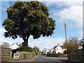
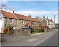
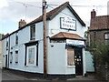
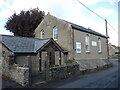
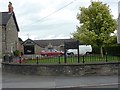
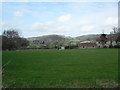
BS48 2AA represents a small residential cluster in Nailsea, a market town located approximately 13 km southwest of Bristol. The area spans just over 7,400 square metres, housing a population of 1,731. This compact size creates a defined community environment where residents often share a close-knit connection to the local landscape and history. Nailsea itself sits within the Portbury Hundred under North Somerset unitary authority. The name likely derives from Old English, meaning Naegl's island. While the area is modest in physical scale, its location offers practical access to wider regional centres. Residents of this postcode benefit from being situated near significant historical landmarks such as Holy Trinity Church, which dates to the 14th–15th century, and Christ Church, built in the 1840s. The neighbourhood retains evidence of its industrial past, including remains of old coal pits and the designated Elms Colliery. For those living in BS48 2AA, daily life balances proximity to the town centre with immediate access to surrounding green spaces. The area avoids major planning constraints such as protected woodlands or wetlands, allowing for straightforward property dynamics within its specific boundaries. It is a location defined by its distinct identity within the North Somerset region rather than by vast urban sprawl.
- Area Type
- Postcode
- Area Size
- 7444 m²
- Population
- Not available
- Population Density
- Not available
BS48 2AA presents a property market characterised by stability and ownership security. The area sees a high level of home ownership at 71%, distinguishing it from zones dominated by private renting. This statistic suggests that most residents have taken a long-term commitment to their homes, which often means properties are well-maintained and suitable for families seeking permanence. The accommodation type is primarily houses, fitting the profile of the 1,731 residents living in this 7,444 square metre area. For buyers considering homes in BS48 2AA, the market reflects an established residential sector rather than a speculative or short-term rental zone. The concentration of owner-occupied households implies a community where property values are likely influenced by local improvements and family presence rather than transient turnover. Given the small size of the postcode cluster and its location within Nailsea, properties here may command a premium for those seeking a specific property type without navigating a larger, more complex urban market. The high ownership percentage also suggests that investment here often benefits from owners looking to improve and hold, creating a predictable market environment for serious buyers.
House Prices in BS48 2AA
Showing 19 properties
| Address | Type | Beds | Baths | Last Sale Price | Last Sale Date | |
|---|---|---|---|---|---|---|
| 51 Silver Street, Nailsea, BS48 2AA | Bungalow | 3 | 2 | £425,000 | Jul 2023 | |
| 47 Silver Street, Nailsea, BS48 2AA | house | - | - | £447,000 | Jul 2022 | |
| 52 Silver Street, Nailsea, BS48 2AA | Cottage | 1 | 1 | £349,995 | Apr 2021 | |
| 41 Silver Street, Nailsea, BS48 2AA | Bungalow | - | - | £335,000 | Jun 2018 | |
| 39 Silver Street, Nailsea, BS48 2AA | Detached | 4 | 3 | £465,000 | Jun 2018 | |
| 45 Silver Street, Nailsea, BS48 2AA | house | - | - | £427,500 | Apr 2018 | |
| 60 Silver Street, Nailsea, BS48 2AA | Semi-detached | 3 | - | £271,000 | May 2017 | |
| 50 Silver Street, Nailsea, BS48 2AA | Cottage | 3 | - | £341,000 | Jun 2015 | |
| 44 Silver Street, Nailsea, BS48 2AA | Terraced | 2 | - | £250,000 | Jan 2015 | |
| 48 Silver Street, Nailsea, BS48 2AA | house | - | - | £236,000 | Aug 2010 |
Energy Efficiency in BS48 2AA
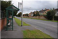
Living in BS48 2AA offers convenient access to a range of amenities and transport links within practical reach. For retail needs, residents find five key options, including Iceland Nailsea and Waitrose Nailsea, alongside The Southern Co-operative Co. These situate daily shopping within walking or short driving distance of the postcode area. Rail travel is equally accessible, with five stations nearby including Nailsea & Backwell Railway Station, Yatton Railway Station, and Portway Park & Ride Railway Station. Transport diversity extends further with two airports in the vicinity, notably Bristol Airport, and three ferry locations such as Clevedon Pier and Portishead Pier. This network allows residents to reach coastal destinations or national hubs without significant travel time. Historically, Nailsea has evolved from a coal and glassworks centre into a market town, and today it reflects this blend of heritage and utility. The presence of well-known retailers and multiple transport nodes ensures that lifestyle needs are met without unnecessary travel. Residents can enjoy a balanced routine, accessing services locally while retaining the option to travel further afield for specific regional events or holidays.
Amenities
Schools
Families living in BS48 2AA have access to established educational institutions nearby. The area is served by Four Oaks Infant School, a primary school that caters to younger children. This presence of a primary school within the vicinity confirms that the neighbourhood supports families with young children and aligns with the area's demographic profile of adults aged 30 to 64 years. For parents resident in this postcode, proximity to such an institution offers daily convenience for morning drop-offs and after-school care arrangements. The specific listing of Four Oaks Infant School indicates a structured local education provision rather than a reliance on distant facilities. While the data highlights only this single primary school, its existence underscores Nailsea's role as a residential hub where infrastructure supports family life. The school type matches the needs of the predominantly adult population, ensuring that families moving into homes in BS48 2AA have immediate access to state education services for their offspring.
| Rank | School | Type | Entry gender | Ages |
|---|
Explore more schools in this area
Go to Schools tabDemographics
The community within BS48 2AA reflects a mature demographic profile. The median age stands at 47 years, placing the population squarely in the adult age range of 30 to 64 years. This indicates a neighbourhood dominated by working-age families and retirees rather than young singles or teenagers. Home ownership is a defining feature of this area, with 71% of households owning their homes outright or with a mortgage. Accommodation in BS48 2AA consists predominantly of houses, aligning with the higher age profile and high ownership rates. The area is ethnically diverse, with the White ethnic group being the predominant demographic. The high level of home ownership suggests a stable community where long-term residents are common, likely driving a local culture of maintenance and investment in property. There are indications of a settled lifestyles where families have established roots in Nailsea for extended periods. The demographic data points away from a transient population, favouring instead a group of adults who prioritize residential stability and family-friendly environments within this specific postcode district.
Household Size
Accommodation Type
Tenure
Ethnic Group
Religion
Household Composition
Age
Household Deprivation
NS-SEC
Explore more demographic insights in this area
Go to Demographics tabPlanning
Planning Constraints
- Flood RiskPremium
- Ramsar Wetland SitesPremium
- Area of Outstanding Natural BeautyPremium
- Protected Nature ReservePremium
- Protected WoodlandPremium