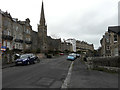
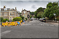
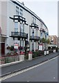
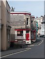
Area Overview for BS23 2LS
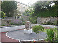
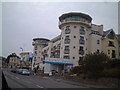
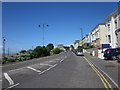
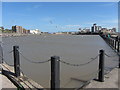
Photos of BS23 2LS


Area Information
BS23 2LS is a small residential postcode area nestled within the historic seaside town of Weston-super-Mare, North Somerset. Covering just 1.0 hectare, it is a compact cluster of homes serving a population of 1,758 residents, with a density of 1,564 people per square kilometre. This area reflects the Victorian legacy of its surroundings, where seaside resorts once thrived as holiday destinations. Daily life here is shaped by proximity to Weston-super-Mare’s amenities, including its iconic Grand Pier and seafront promenade, though the postcode itself is a quiet residential enclave. The community is closely knit, with residents benefitting from nearby rail links, a ferry service, and a range of local shops. While the area lacks large-scale developments, its compact size fosters a sense of familiarity. The median age of 47 suggests a mature population, with adults aged 30–64 forming the largest demographic. This blend of history and practicality makes BS23 2LS a niche choice for those seeking a residential slice of a well-known coastal town.
- Area Type
- Postcode
- Area Size
- 1.0 hectares
- Population
- 1758
- Population Density
- 1564 people/km²
The property market in BS23 2LS is characterised by a 48% home ownership rate, meaning the majority of residents are likely to be renting. The primary accommodation type is flats, which dominates the housing stock in this small area. This suggests a focus on smaller, manageable properties, possibly catering to singles, couples, or small families. The limited area size of 1.0 hectare means the housing stock is constrained, with little scope for expansion. For buyers, this implies a niche market with limited options, though proximity to Weston-super-Mare’s amenities and transport links may offset the area’s compact nature. The predominance of flats also indicates a rental-oriented market, where landlords may hold significant shares of the property stock. Buyers should consider the practicalities of living in a densely populated postcode, where space is at a premium but access to local services is within reach.
House Prices in BS23 2LS
Showing 6 properties
| Address | Type | Beds | Baths | Last Sale Price | Last Sale Date | |
|---|---|---|---|---|---|---|
| 74 South Road, Weston Super Mare, BS23 2LS | Retail | 1 | 1 | £440,000 | Apr 2022 | |
| 42, Pine Court, South Road, Weston Super Mare, BS23 2LS | Flat | - | - | £76,500 | Jun 2008 | |
| 43, Pine Court, South Road, Weston Super Mare, BS23 2LS | Flat | - | - | £78,000 | Aug 2007 | |
| 40, Pine Court, South Road, Weston Super Mare, BS23 2LS | Flat | - | - | £41,000 | Dec 1997 | |
| 41, Pine Court, South Road, Weston Super Mare, BS23 2LS | Flat | - | - | £20,000 | Apr 1995 | |
| 44, Pine Court, South Road, Weston Super Mare, BS23 2LS | Flat | - | - | - | - |
Energy Efficiency in BS23 2LS
Living in BS23 2LS offers access to a range of nearby amenities, including five retail outlets such as Spar, Tesco Weston, and Morrisons Daily Weston Super, ensuring everyday shopping needs are met. A ferry service to Weston connects residents to the town’s coastal attractions, while three rail stations—Weston, Weston Milton, and Worle—provide links to further destinations. The area’s compact nature means these amenities are within practical reach, fostering a convenient lifestyle. Though the postcode itself is residential, its proximity to Weston-super-Mare’s historic seafront, Victorian architecture, and cultural landmarks adds to its appeal. The presence of multiple retail options and transport links suggests a community that values accessibility and practicality, with daily life revolving around local services and easy access to the broader town.
Amenities
Schools
| Rank | School | Type | Entry gender | Ages |
|---|
Explore more schools in this area
Go to Schools tabDemographics
The population of BS23 2LS is predominantly adults aged 30–64, with a median age of 47. This suggests a community of established professionals, retirees, and families with children. Home ownership is relatively low at 48%, indicating that nearly half of residents are likely to be renting. The accommodation type is largely flats, reflecting a housing stock suited to smaller households or those seeking manageable living spaces. The predominant ethnic group is White, though specific data on diversity is not provided. The age profile and ownership figures suggest a stable, long-term resident base rather than a transient population. With no data on deprivation levels, it is unclear how economic factors might influence quality of life, but the high population density implies a mix of housing needs and community interactions. The area’s demographics align with its role as a residential cluster within a larger town, where proximity to amenities and transport may outweigh the limitations of a small, compact postcode.
Household Size
Accommodation Type
Tenure
Ethnic Group
Religion
Household Composition
Age
Household Deprivation
NS-SEC
Explore more demographic insights in this area
Go to Demographics tabPlanning
Planning Constraints
- Flood RiskPremium
- Ramsar Wetland SitesPremium
- Area of Outstanding Natural BeautyPremium
- Protected Nature ReservePremium
- Protected WoodlandPremium