Area Overview for BS23 2LH
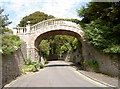
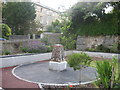
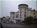
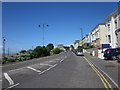
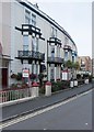
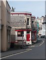
Photos of BS23 2LH


Area Information
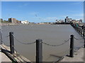
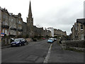
BS23 2LH is a small, densely populated postcode area in England, covering 6,524 square metres and home to 1,461 residents. Its compact size and high population density of 223,928 people per square kilometre reflect a tightly knit residential cluster. Situated in the historic town of Weston-super-Mare, this area benefits from its proximity to a Victorian seaside resort known for its sandy beaches and high tidal range. Daily life here is shaped by its coastal location, with a mix of modern amenities and heritage. The area’s demographics suggest a mature community, with a median age of 47 and a majority of residents aged 30–64. While it lacks the sprawling infrastructure of larger towns, its proximity to retail, transport, and coastal attractions offers a balance of convenience and character. For those seeking a compact, well-connected home near a historic seaside town, BS23 2LH presents a distinct blend of residential density and accessible amenities.
- Area Type
- Postcode
- Area Size
- 6524 m²
- Population
- Not available
- Population Density
- Not available
The property market in BS23 2LH is characterised by a high rate of home ownership (67%) and a dominance of flats as the primary accommodation type. This suggests a housing stock that caters to smaller households or those prioritising manageable, low-maintenance living. The prevalence of flats may indicate limited availability of larger homes or detached properties, making this area more suitable for buyers seeking compact, well-serviced residences. Given the postcode’s small size, the immediate surroundings likely offer few alternative housing options, reinforcing the importance of proximity to amenities. Buyers should consider the practical implications of flat living, such as shared walls and communal spaces, while also recognising the stability of a high home ownership rate. The area’s compact nature may also mean that property values are influenced more by location and local infrastructure than by broader regional trends.
House Prices in BS23 2LH
Showing 17 properties
| Address | Type | Beds | Baths | Last Sale Price | Last Sale Date | |
|---|---|---|---|---|---|---|
| 13A Queens Road, Weston Super Mare, BS23 2LH | Flat | 2 | 1 | £228,000 | Sep 2024 | |
| 15A Queens Road, Weston Super Mare, BS23 2LH | Flat | - | - | £225,000 | Dec 2022 | |
| 35 Queens Road, Weston Super Mare, BS23 2LH | Retail | 5 | 3 | £590,000 | Nov 2022 | |
| 29 Queens Road, Weston Super Mare, BS23 2LH | Detached | 5 | 3 | £730,000 | Feb 2021 | |
| 25 Queens Road, Weston Super Mare, BS23 2LH | Semi-detached | 4 | 2 | £308,750 | Sep 2009 | |
| 17A Queens Road, Weston Super Mare, BS23 2LH | Flat | 3 | 1 | £62,000 | May 2000 | |
| 23 Queens Road, Weston Super Mare, BS23 2LH | Flat | 2 | 2 | - | - | |
| 27 Queens Road, Weston Super Mare, BS23 2LH | Flat | - | - | - | - | |
| Ground Flat, 13 Queens Road, Weston Super Mare, BS23 2LH | Flat | - | - | - | - | |
| Top Flat, 13 Queens Road, Weston Super Mare, BS23 2LH | Flat | - | - | - | - |
Energy Efficiency in BS23 2LH
Living in BS23 2LH offers access to a range of practical amenities within easy reach. The area is served by five retail outlets, including Spar, Tesco Weston, and Morrisons Daily Weston Super, ensuring everyday shopping needs are met without long journeys. A ferry service in Weston provides additional mobility, particularly for residents relying on maritime transport. Three railway stations—Weston, Weston Milton, and Worle—offer connections to nearby destinations, enhancing the area’s accessibility. While the data does not specify parks or leisure facilities, the proximity to Weston-super-Mare’s historic seafront and Victorian architecture suggests opportunities for walking, sightseeing, and cultural engagement. The combination of retail, transport, and coastal proximity creates a lifestyle that balances convenience with the charm of a historic seaside town.
Amenities
Schools
| Rank | School | Type | Entry gender | Ages |
|---|
Explore more schools in this area
Go to Schools tabDemographics
The community in BS23 2LH is predominantly composed of adults aged 30–64, with a median age of 47. This suggests a population skewed towards professionals, families, and middle-aged residents. Home ownership rates stand at 67%, indicating a stable, owner-occupied community, though rental options may be limited given the area’s small size. The accommodation type is predominantly flats, reflecting a housing stock tailored to smaller households or those prioritising convenience over larger properties. The predominant ethnic group is White, though the data does not provide further breakdowns of diversity. The high population density, combined with a mature age profile, suggests a community focused on established living rather than transient populations. This demographic profile may influence local services and amenities, with a focus on meeting the needs of long-term residents over transient visitors.
Household Size
Accommodation Type
Tenure
Ethnic Group
Religion
Household Composition
Age
Household Deprivation
NS-SEC
Explore more demographic insights in this area
Go to Demographics tabPlanning
Planning Constraints
- Flood RiskPremium
- Ramsar Wetland SitesPremium
- Area of Outstanding Natural BeautyPremium
- Protected Nature ReservePremium
- Protected WoodlandPremium