Area Overview for BS23 2LN
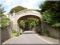
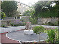
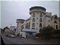
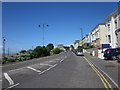
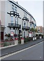
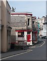
Photos of BS23 2LN


Area Information
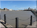
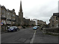
Living in BS23 2LN means being part of a tightly packed residential cluster in North Somerset, nestled within the historic town of Weston-super-Mare. The area covers just 9,033 square metres, housing 1,461 people in a dense, compact layout. With a population density of 161,738 people per square kilometre, this is a highly concentrated community, typical of small urban pockets in coastal towns. The postcode falls within a town defined by its Victorian heritage, sandy beaches, and a long history as a seaside resort. Residents benefit from proximity to Weston-super-Mare’s amenities, including its iconic Grand Pier and Victorian architecture, while the area’s compact size fosters a tight-knit feel. Despite its small footprint, the postcode connects to broader networks of rail, retail, and transport, making it a practical base for those seeking a blend of coastal charm and urban convenience. The area’s character is shaped by its history as a 19th-century resort, with roads and infrastructure laid out during the Enclosure Acts of the 1810s. For buyers, this is a place where heritage meets modern living, with a focus on proximity to essential services and a community defined by its compact, high-density layout.
- Area Type
- Postcode
- Area Size
- 9033 m²
- Population
- Not available
- Population Density
- Not available
The property market in BS23 2LN is characterised by a high proportion of flats, with 67% of homes owner-occupied. This suggests a mix of long-term residents and a limited rental market, as the area’s compact size and density make it less suited to large-scale new builds. The prevalence of flats indicates a focus on multi-unit housing, which is typical in urban or semi-urban areas with space constraints. Buyers should consider that the small area size—just 9,033 square metres—means housing stock is tightly concentrated, potentially limiting options for those seeking larger properties. The high home ownership rate also implies a stable market, with fewer short-term rentals or speculative investments. For those looking to buy, the area’s proximity to Weston-super-Mare’s amenities and transport links may offset the lack of expansive housing options. However, the density could also mean competition for available properties, particularly for those prioritising space or specific property types. Prospective buyers should also factor in the area’s historical development, which may influence property values and architectural styles.
House Prices in BS23 2LN
Showing 35 properties
| Address | Type | Beds | Baths | Last Sale Price | Last Sale Date | |
|---|---|---|---|---|---|---|
| 8 Grove Park Road, Weston Super Mare, BS23 2LN | Semi-detached | 5 | 2 | £590,000 | Oct 2025 | |
| 28 Grove Park Road, Weston Super Mare, BS23 2LN | Detached | 4 | 1 | £232,000 | Jan 2025 | |
| 26A Grove Park Road, Weston Super Mare, BS23 2LN | Detached | 4 | 2 | £440,000 | Aug 2022 | |
| 6 Grove Park Road, Weston Super Mare, BS23 2LN | Flat | 3 | 1 | £210,000 | Sep 2021 | |
| 22 Grove Park Road, Weston Super Mare, BS23 2LN | house | - | - | £470,000 | Aug 2021 | |
| 26 Grove Park Road, Weston Super Mare, BS23 2LN | Detached | 4 | 3 | £642,200 | Jan 2018 | |
| 2 Grove Park Road, Weston Super Mare, BS23 2LN | Flat | - | - | £170,000 | Nov 2016 | |
| Amarantha House, 20 Grove Park Road, Weston Super Mare, BS23 2LN | Semi-detached | 4 | 3 | £375,000 | Jul 2016 | |
| 2A Grove Park Road, Weston Super Mare, BS23 2LN | Semi-detached | 2 | 2 | £275,000 | May 2015 | |
| 24 Grove Park Road, Weston Super Mare, BS23 2LN | Flat | - | - | £435,000 | May 2007 |
Energy Efficiency in BS23 2LN
Residents of BS23 2LN have access to a range of nearby amenities that support daily life. The area is within practical reach of five retail outlets, including Spar, Tesco Weston, and Morrisons Daily Weston Super, ensuring convenience for grocery shopping and everyday needs. The presence of a ferry service at Weston adds to the area’s connectivity, while three rail stations—Weston, Weston Milton, and Worle—offer regular transport options to nearby towns and cities. These transport links are complemented by the area’s proximity to Weston-super-Mare’s historic seafront, Victorian architecture, and the Grand Pier, which provide leisure opportunities. The compact layout of the postcode means residents can reach essential services quickly, though the high population density may lead to busier local spaces. For those seeking a mix of convenience and coastal charm, BS23 2LN offers a balance of retail, transport, and proximity to the town’s cultural and recreational assets. The area’s small size ensures that amenities are closely clustered, making it practical for those prioritising walkability and ease of access.
Amenities
Schools
| Rank | School | Type | Entry gender | Ages |
|---|
Explore more schools in this area
Go to Schools tabDemographics
The community in BS23 2LN is predominantly middle-aged, with a median age of 47 and the majority of residents falling within the 30-64 age range. This suggests a population skewed towards working-age adults and retirees, with fewer young families. Home ownership is high at 67%, indicating a stable, long-term resident base, though the area’s accommodation is largely flats rather than detached homes. This reflects a trend common in compact urban areas where multi-unit housing dominates. The predominant ethnic group is White, though specific data on diversity is not provided. The high population density—161,738 people per square kilometre—means the area is intensely populated, which can influence local dynamics such as community cohesion and access to shared resources. While no explicit data on deprivation is included, the high home ownership rate and age profile suggest a relatively stable socioeconomic environment. However, the concentration of residents in a small area may also mean limited space for expansion or new developments, which could affect housing availability and affordability for future buyers.
Household Size
Accommodation Type
Tenure
Ethnic Group
Religion
Household Composition
Age
Household Deprivation
NS-SEC
Explore more demographic insights in this area
Go to Demographics tabPlanning
Planning Constraints
- Flood RiskPremium
- Ramsar Wetland SitesPremium
- Area of Outstanding Natural BeautyPremium
- Protected Nature ReservePremium
- Protected WoodlandPremium