Area Overview for BS23 2JF
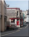
Photos of BS23 2JF


Area Information
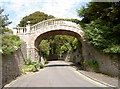
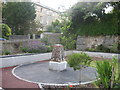
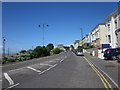
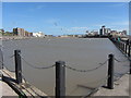
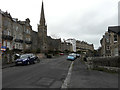
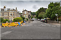
BS23 2JF is a compact postcode area within the historic seaside town of Weston-super-Mare, a Victorian resort town on the Bristol Channel. Covering 3,351 m², it is densely populated, with 1,594 residents living at a density of 475,623 people per km². This small cluster is part of a larger town known for its sandy beaches, high tides, and 19th-century development as a holiday destination. The area is defined by its proximity to Weston-super-Mare’s seafront, with a mix of residential flats and historic architecture. Daily life here is shaped by the town’s coastal character, with easy access to its promenades, historic buildings, and transport links. The median age of 47 suggests a mature community, with many residents in their 30s to 60s. While the area lacks large-scale amenities, its integration with Weston-super-Mare’s infrastructure ensures access to shops, rail, and ferry services. Living here means embracing a tightly knit, historic environment with a focus on local heritage and coastal living.
- Area Type
- Postcode
- Area Size
- 3351 m²
- Population
- Not available
- Population Density
- Not available
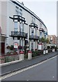
The property market in BS23 2JF is characterised by a high proportion of flats, with 49% of residents owning their homes. This suggests a mix of owner-occupied and rental properties, though the low home ownership rate indicates a significant portion of the housing stock is rented. Given the area’s small size and high density, the market is likely limited to a few properties, with limited scope for new development. Flats dominate, reflecting a preference for compact, low-maintenance living. For buyers, this means a focus on existing stock rather than new builds, with potential for investment in rental properties. However, the small area and proximity to Weston-super-Mare’s amenities may make it attractive to those seeking affordable housing near coastal and historic sites. The market is likely competitive, with limited options for larger homes or family properties.
House Prices in BS23 2JF
Showing 19 properties
| Address | Type | Beds | Baths | Last Sale Price | Last Sale Date | |
|---|---|---|---|---|---|---|
| 9 Shrubbery Walk West, Weston Super Mare, BS23 2JF | Flat | - | - | £165,000 | Aug 2025 | |
| Jessop, Shrubbery Walk West, Weston Super Mare, BS23 2JF | Flat | 2 | 1 | £250,000 | Oct 2023 | |
| 7A Shrubbery Walk West, Weston Super Mare, BS23 2JF | Flat | - | - | £137,000 | Aug 2011 | |
| 2, Braeside, Shrubbery Walk West, Weston Super Mare, BS23 2JF | Maisonette | 1 | 1 | - | - | |
| Proposed New Dwelling At Rosemary, Shrubbery Road, Weston Super Mare, BS23 2JF | Detached | - | - | - | - | |
| 1, Braeside, Shrubbery Walk West, Weston Super Mare, BS23 2JF | Flat | - | - | - | - | |
| 3, Braeside, Shrubbery Walk West, Weston Super Mare, BS23 2JF | Flat | - | - | - | - | |
| Middle Floor Flat, 7 Shrubbery Walk West, Weston Super Mare, BS23 2JF | Flat | - | - | - | - | |
| Top Flat 1, 7 Shrubbery Walk West, Weston Super Mare, BS23 2JF | Flat | - | - | - | - | |
| Second Floor Flat, 9 Shrubbery Walk West, Weston Super Mare, BS23 2JF | Flat | - | - | - | - |
Energy Efficiency in BS23 2JF
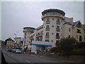
Living in BS23 2JF offers access to Weston-super-Mare’s historic and coastal amenities, with nearby shops, dining, and transport. The area is within walking distance of retail options such as Spar, Tesco Weston, and Morrisons Daily Weston Super, ensuring convenience for daily needs. The three rail stations—Weston, Weston Milton, and Worle—provide direct links to regional hubs, while the ferry service connects to the town’s seafront. The proximity to Weston-super-Mare’s landmarks, including the Grand Pier and Old Thatched Cottage Restaurant, adds to the area’s charm. Residents can enjoy a mix of historic architecture, coastal walks, and local events. The compact nature of the area fosters a sense of community, with amenities clustered closely for ease of access. This blend of practicality and heritage makes daily life here both functional and rooted in the town’s seaside identity.
Amenities
Schools
| Rank | School | Type | Entry gender | Ages |
|---|
Explore more schools in this area
Go to Schools tabDemographics
The population of BS23 2JF has a median age of 47, with the majority of residents aged between 30 and 64. This indicates a community of middle-aged adults, likely settled in long-term housing. Home ownership stands at 49%, meaning nearly half of residents rent their homes, suggesting a mix of owner-occupied and rental properties. The predominant accommodation type is flats, reflecting a housing stock suited to smaller households or those seeking low-maintenance living. The area’s predominant ethnic group is White, with no specific data on other demographics. The high population density of 475,623 people per km² implies a compact, possibly older residential cluster. This density may influence local services and community dynamics, with a focus on shared spaces and proximity to amenities. The age profile and ownership figures suggest a stable, established community with limited turnover, shaped by the area’s historic character and limited expansion.
Household Size
Accommodation Type
Tenure
Ethnic Group
Religion
Household Composition
Age
Household Deprivation
NS-SEC
Explore more demographic insights in this area
Go to Demographics tabPlanning
Planning Constraints
- Flood RiskPremium
- Ramsar Wetland SitesPremium
- Area of Outstanding Natural BeautyPremium
- Protected Nature ReservePremium
- Protected WoodlandPremium