Area Overview for BS23 2DY
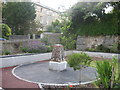
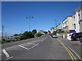
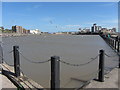
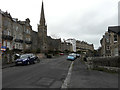
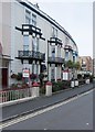
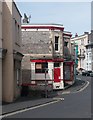
Photos of BS23 2DY


Area Information
BS23 2DY is a compact residential postcode nestled in the heart of Weston-super-Mare, a historic seaside town in North Somerset. With a population of 1,594 spread across 2,873 square metres, the area is densely populated yet retains a small-town character. The postcode’s proximity to the Bristol Channel and its Victorian heritage define daily life, blending coastal charm with modern convenience. Residents benefit from nearby ferry services to Weston, rail links to Weston, Weston Milton, and Worle stations, and a range of retail options including Spar, Tesco, and Morrisons. The area’s high population density reflects its role as a commuter hub, with many residents working in nearby towns or the wider Somerset region. Despite its size, BS23 2DY offers access to Weston-super-Mare’s amenities, from its iconic Grand Pier to its Victorian architecture. The community is predominantly middle-aged, with a median age of 47, and features a mix of owner-occupied and rented properties. This postcode is ideal for those seeking a balance between coastal living and practical connectivity.
- Area Type
- Postcode
- Area Size
- 2873 m²
- Population
- Not available
- Population Density
- Not available
The property market in BS23 2DY is characterised by a 49% home ownership rate, meaning nearly half of residents rent their homes. This suggests a rental market that caters to both short- and long-term tenants, particularly given the area’s role as a commuter hub. The primary accommodation type is flats, which dominate the housing stock. This configuration is typical of densely populated urban areas and may appeal to buyers seeking affordable, compact living spaces. However, the small size of the postcode—just 2,873 square metres—means the housing stock is limited, and buyers should consider the proximity to nearby towns for more extensive property options. The prevalence of flats also indicates a focus on efficiency, with shared walls and communal spaces common. For those prioritising ownership, the market may present opportunities for investment, though competition could be fierce given the area’s appeal.
House Prices in BS23 2DY
Showing 15 properties
| Address | Type | Beds | Baths | Last Sale Price | Last Sale Date | |
|---|---|---|---|---|---|---|
| 54 Upper Church Road, Weston Super Mare, BS23 2DY | Cottage | 3 | 2 | £255,500 | May 2020 | |
| 56 Upper Church Road, Weston Super Mare, BS23 2DY | Detached | 4 | - | £245,000 | Sep 2006 | |
| 46A Upper Church Road, Weston Super Mare, BS23 2DY | Flat | 2 | 1 | £53,500 | Jul 2002 | |
| 50A Upper Church Road, Weston Super Mare, BS23 2DY | Flat | 1 | 1 | £50,000 | Jul 2000 | |
| 47 Upper Church Road, Weston Super Mare, BS23 2DY | Terraced | 3 | 1 | - | - | |
| Bottom Flat, 51 Upper Church Road, Weston Super Mare, BS23 2DY | Flat | 6 | 6 | - | - | |
| 48 Upper Church Road, Weston Super Mare, BS23 2DY | Semi-detached | - | - | - | - | |
| Flat 2, 51 Upper Church Road, Weston Super Mare, BS23 2DY | Maisonette | - | - | - | - | |
| Basement Flat, 53 Upper Church Road, Weston Super Mare, BS23 2DY | Flat | - | - | - | - | |
| First Floor Flat, 51 Upper Church Road, Weston Super Mare, BS23 2DY | Flat | - | - | - | - |
Energy Efficiency in BS23 2DY
Living in BS23 2DY offers a blend of practicality and coastal charm. Within reach are essential retail outlets such as Spar, Tesco Weston, and Morrisons Daily Weston Super, providing convenience for daily shopping. The area’s rail stations—Weston, Weston Milton, and Worle—offer easy access to nearby towns and the wider South West. For residents drawn to the sea, the nearby ferry service to Weston connects to the Bristol Channel, enhancing mobility for coastal excursions. The postcode’s proximity to Weston-super-Mare means residents can enjoy the town’s historic attractions, including the Grand Pier and Victorian architecture. The compact nature of the area ensures amenities are within walking distance, while the rail links provide access to broader opportunities. This balance of local convenience and regional connectivity defines the lifestyle in BS23 2DY.
Amenities
Schools
| Rank | School | Type | Entry gender | Ages |
|---|
Explore more schools in this area
Go to Schools tabDemographics
The population of BS23 2DY has a median age of 47, with the majority of residents aged between 30 and 64. This suggests a mature, established community with a strong presence of working-age adults. Home ownership in the area stands at 49%, indicating a mix of owner-occupied and rented properties. The primary accommodation type is flats, which aligns with the area’s high population density of 554,819 people per square kilometre. The predominant ethnic group is White, reflecting the broader demographic trends in Weston-super-Mare. While the data does not specify further diversity metrics, the age profile and housing stock suggest a community focused on stability and long-term residency. The high density, however, may impact living space per household, though the area’s amenities and transport links mitigate potential overcrowding concerns.
Household Size
Accommodation Type
Tenure
Ethnic Group
Religion
Household Composition
Age
Household Deprivation
NS-SEC
Explore more demographic insights in this area
Go to Demographics tabPlanning
Planning Constraints
- Flood RiskPremium
- Ramsar Wetland SitesPremium
- Area of Outstanding Natural BeautyPremium
- Protected Nature ReservePremium
- Protected WoodlandPremium