Area Overview for BS23 2JA
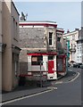
Photos of BS23 2JA


Area Information
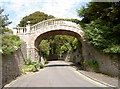
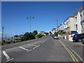
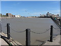
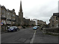
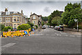
BS23 2JA is a small residential postcode nestled within the historic town of Weston-super-Mare, a Victorian seaside resort in North Somerset. With a population of 1,594 spread over 3,578 square metres, this area is densely populated yet retains a compact, community-oriented character. The town’s origins as a 19th-century holiday destination are evident in its seafront promenades, Victorian architecture, and landmarks like the Grand Pier. Residents here benefit from proximity to the Bristol Channel, with a ferry service to Weston and multiple rail stations offering connections to nearby towns. Daily life is shaped by the area’s mix of historic charm and modern convenience, from independent shops to transport links. The demographic profile—predominantly adults aged 30–64—suggests a stable, established community. While the postcode’s small size means limited housing options, its strategic location near retail, leisure, and transport hubs makes it appealing for those seeking a balance between coastal living and practicality.
- Area Type
- Postcode
- Area Size
- 3578 m²
- Population
- Not available
- Population Density
- Not available
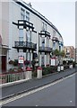
The property market in BS23 2JA is characterised by a 49% home ownership rate, with flats making up the majority of accommodation types. This suggests a rental-oriented market, where landlords and tenants dominate over owner-occupiers. The small size of the postcode—just 3,578 square metres—means housing stock is limited, and buyers may find competition for the few available properties. Flats are the norm, which aligns with the area’s compact nature and proximity to amenities. For those seeking larger homes or detached properties, the immediate surroundings of Weston-super-Mare offer broader options, though the postcode itself is unlikely to cater to such demands. The high population density also implies that properties here are often in high demand, particularly for those prioritising convenience over space. Buyers should consider the area’s role as a gateway to coastal and transport amenities when evaluating its appeal.
House Prices in BS23 2JA
Showing 17 properties
| Address | Type | Beds | Baths | Last Sale Price | Last Sale Date | |
|---|---|---|---|---|---|---|
| 4 Shrubbery Road, Weston Super Mare, BS23 2JA | Semi-detached | 4 | 1 | £500,000 | Nov 2023 | |
| 10 Shrubbery Road, Weston Super Mare, BS23 2JA | Flat | - | - | £190,000 | Apr 2022 | |
| 1B Shrubbery Road, Weston Super Mare, BS23 2JA | Semi-detached | 3 | 1 | £235,000 | Jan 2022 | |
| 12 Shrubbery Road, Weston Super Mare, BS23 2JA | Flat | 2 | 1 | £185,000 | Apr 2021 | |
| 1C Shrubbery Road, Weston Super Mare, BS23 2JA | Flat | 2 | 1 | £270,000 | Mar 2018 | |
| 1A Shrubbery Road, Weston Super Mare, BS23 2JA | Semi-detached | 3 | 2 | £135,000 | Jun 2002 | |
| 6 Shrubbery Road, Weston Super Mare, BS23 2JA | Flat | 2 | 1 | £28,000 | Oct 1995 | |
| 8 Shrubbery Road, Weston Super Mare, BS23 2JA | Retail | 2 | 1 | - | - | |
| First Floor Flat, 8 Shrubbery Road, Weston Super Mare, BS23 2JA | Flat | - | - | - | - | |
| Top Floor Flat, 8 Shrubbery Road, Weston Super Mare, BS23 2JA | Flat | - | - | - | - |
Energy Efficiency in BS23 2JA
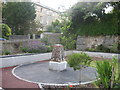
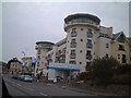
Living in BS23 2JA offers access to a range of amenities within practical reach. The area is served by five retail outlets, including Spar, Tesco Weston, and Morrisons Daily Weston Super, providing essential shopping and dining options. For transport, three rail stations—Weston, Weston Milton, and Worle—offer connections to regional centres, while a ferry service to Weston enhances mobility. The proximity to the seafront and historic sites like the Grand Pier and Old Thatched Cottage Restaurant adds cultural and recreational value. The Victorian architecture and seafront promenades contribute to a distinct coastal character, blending heritage with modern convenience. Residents can enjoy leisure activities, from walking along the promenade to visiting local eateries. The compact nature of the area ensures that amenities are never far, making daily life efficient and accessible for those prioritising convenience over expansive space.
Amenities
Schools
| Rank | School | Type | Entry gender | Ages |
|---|
Explore more schools in this area
Go to Schools tabDemographics
The population of BS23 2JA is 1,594, with a median age of 47 and the majority of residents aged between 30 and 64. This suggests a mature, stable community with a focus on established households. Home ownership accounts for 49% of properties, while the remaining 51% are likely rented, reflecting a mix of owner-occupied and rental housing. The area is predominantly composed of flats, a common feature in smaller urban postcode clusters. The predominant ethnic group is White, though no specific diversity statistics are provided. The high population density of 445,538 people per square kilometre indicates a compact, closely knit neighbourhood. This density, combined with the age profile, suggests a community centred on long-term residents rather than transient populations. The absence of specific deprivation data means quality of life indicators are not quantified here, but the demographic stability points to a resilient local economy.
Household Size
Accommodation Type
Tenure
Ethnic Group
Religion
Household Composition
Age
Household Deprivation
NS-SEC
Explore more demographic insights in this area
Go to Demographics tabPlanning
Planning Constraints
- Flood RiskPremium
- Ramsar Wetland SitesPremium
- Area of Outstanding Natural BeautyPremium
- Protected Nature ReservePremium
- Protected WoodlandPremium