Area Overview for BS23 2JG
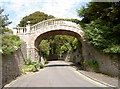
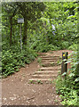
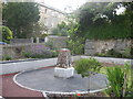
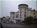
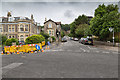
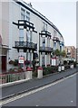
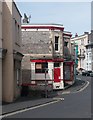
Photos of BS23 2JG

Area Information
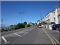
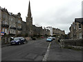
BS23 2JG is a tightly packed residential postcode in North Somerset, home to 1,594 people across 6,617 square metres. Its high population density of 240,908 people per square kilometre reflects a compact, closely knit community. Situated near Weston-super-Mare, a historic Victorian seaside resort, the area benefits from proximity to coastal attractions like the Grand Pier and the town’s iconic seafront. Daily life here is shaped by its small-scale character, with residents enjoying easy access to nearby amenities and transport links. The postcode’s limited size means it is a microcosm of the broader town, where heritage and modernity coexist. With a median age of 47 and a population skewed toward adults aged 30–64, the area is neither dominated by students nor retirees, creating a stable, mature community. Living in BS23 2JG offers a blend of practicality and coastal charm, ideal for those seeking a manageable, well-connected residential environment without the sprawl of larger towns.
- Area Type
- Postcode
- Area Size
- 6617 m²
- Population
- Not available
- Population Density
- Not available
The property market in BS23 2JG is characterised by a high proportion of flats, with 49% of homes owner-occupied and the remainder likely rented. This suggests a mix of private and rental properties, though the limited area size means housing stock is constrained. The dominance of flats indicates a focus on compact, efficient living, which aligns with the area’s high population density. For buyers, this dynamic creates a competitive market, particularly for owner-occupied properties, which may be scarce. The small postcode area means that any available homes are likely to be in close proximity to local amenities, such as the rail stations at Weston and Worle. However, the limited size of BS23 2JG also means that the immediate surroundings are critical for property availability, with nearby areas like Weston-super-Mare offering broader options for those seeking more varied housing types.
House Prices in BS23 2JG
Showing 12 properties
Energy Efficiency in BS23 2JG
Living in BS23 2JG offers access to a range of essential amenities within close reach. The area is served by five retail outlets, including Spar, Tesco Weston, and Morrisons Daily Weston Super, ensuring residents have convenient shopping options for everyday needs. Three rail stations—Weston, Weston Milton, and Worle—provide easy access to local and regional transport networks, while a ferry service to Weston adds flexibility for travel. The proximity to Weston-super-Mare, a historic seaside town, means residents can enjoy coastal walks, dining, and leisure activities. The compact nature of the area means that daily life is efficient, with minimal travel required to access shops, transport, and community hubs. This blend of practicality and connectivity makes BS23 2JG a convenient base for those seeking a balanced lifestyle.
Amenities
Schools
| Rank | School | Type | Entry gender | Ages |
|---|
Explore more schools in this area
Go to Schools tabDemographics
The community in BS23 2JG is predominantly composed of adults aged 30–64, with a median age of 47. This suggests a mature, established population, likely with long-term ties to the area. Home ownership here is relatively low at 49%, indicating that a majority of residents are renters, which may reflect the area’s focus on flats as the primary accommodation type. The demographic profile is largely homogenous, with the White ethnic group forming the predominant group. This composition contributes to a stable, cohesive community, though it also means diversity is limited. The absence of specific data on deprivation or income levels means the area’s quality of life cannot be fully assessed, but the age profile and housing stock suggest a practical, no-frills lifestyle. The high population density, combined with the prevalence of flats, points to a compact, functional living environment tailored for those prioritising proximity to services over expansive space.
Household Size
Accommodation Type
Tenure
Ethnic Group
Religion
Household Composition
Age
Household Deprivation
NS-SEC
Explore more demographic insights in this area
Go to Demographics tabPlanning
Planning Constraints
- Flood RiskPremium
- Ramsar Wetland SitesPremium
- Area of Outstanding Natural BeautyPremium
- Protected Nature ReservePremium
- Protected WoodlandPremium