Area Overview for BS11 0SY
Photos of BS11 0SY

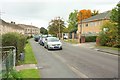
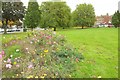
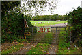
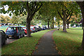
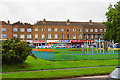

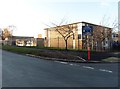
23 photos from this area
Area Information
Key information about the BS11 0SY including its size, population, and administrative classification.
- Area Type
- Postcode
- Area Size
- 1.1 hectares
- Population
- 1673
- Population Density
- 1586 people/km²
House Prices in BS11 0SY
28
Properties
£161,462
Average Sold Price
£80,000
Lowest Price
£225,000
Highest Price
Showing 28 properties
| Address | Type | Beds | Baths | Last Sale Price | Last Sale Date | |
|---|---|---|---|---|---|---|
| 8 Aylminton Walk, Lawrence Weston, Bristol, BS11 0SY | house | - | - | £196,000 | Jan 2022 | |
| 44 Aylminton Walk, Lawrence Weston, Bristol, BS11 0SY | Terraced | 3 | 1 | £210,000 | Mar 2021 | |
| 12 Aylminton Walk, Lawrence Weston, Bristol, BS11 0SY | house | - | - | £200,000 | Oct 2020 | |
| 20 Aylminton Walk, Lawrence Weston, Bristol, BS11 0SY | house | - | - | £205,000 | Sep 2020 | |
| 14 Aylminton Walk, Lawrence Weston, Bristol, BS11 0SY | house | - | - | £110,000 | Dec 2018 | |
| 22 Aylminton Walk, Lawrence Weston, Bristol, BS11 0SY | Terraced | 4 | 1 | £225,000 | Sep 2018 | |
| 56 Aylminton Walk, Lawrence Weston, Bristol, BS11 0SY | Semi-detached | 3 | - | £195,000 | Sep 2018 | |
| 38 Aylminton Walk, Lawrence Weston, Bristol, BS11 0SY | house | - | - | £180,000 | Feb 2016 | |
| 32 Aylminton Walk, Lawrence Weston, Bristol, BS11 0SY | Semi-detached | 3 | 1 | £148,000 | Apr 2014 | |
| 42 Aylminton Walk, Lawrence Weston, Bristol, BS11 0SY | Terraced | - | - | £161,000 | Jan 2008 |
Page 1 of 3
Energy Efficiency in BS11 0SY
Amenities
Schools
| Rank | School | Type | Entry gender | Ages |
|---|
Explore more schools in this area
Go to Schools tabDemographics
Household Size
Family (3-5 people)
most common
Accommodation Type
Houses
most common
Tenure
52
majority
Ethnic Group
White
most common
Religion
N/A
most common
Household Composition
N/A
most common
Age
47
median
Adults (30-64 years)
most common
Household Deprivation
N/A
with no deprivation
NS-SEC
19
in Lower managerial occupations
Explore more demographic insights in this area
Go to Demographics tabPlanning
Planning Constraints
- Flood RiskPremium
- Ramsar Wetland SitesPremium
- Area of Outstanding Natural BeautyPremium
- Protected Nature ReservePremium
- Protected WoodlandPremium