Area Overview for BS11 0SP
Photos of BS11 0SP

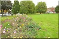
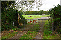
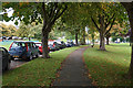
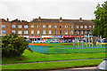

23 photos from this area
Area Information
Key information about the BS11 0SP including its size, population, and administrative classification.
- Area Type
- Postcode
- Area Size
- 4946 m²
- Population
- 1673
- Population Density
- 1586 people/km²
House Prices in BS11 0SP
12
Properties
£156,714
Average Sold Price
£1,000
Lowest Price
£271,000
Highest Price
Showing 12 properties
| Address | Type | Beds | Baths | Last Sale Price | Last Sale Date | |
|---|---|---|---|---|---|---|
| 54 Atwood Drive, Lawrence Weston, Bristol, BS11 0SP | Retail | 3 | 1 | £260,000 | Oct 2022 | |
| 70 Atwood Drive, Lawrence Weston, Bristol, BS11 0SP | Terraced | 5 | 1 | £271,000 | Nov 2021 | |
| 64 Atwood Drive, Lawrence Weston, Bristol, BS11 0SP | Semi-detached | - | - | £1,000 | Nov 2019 | |
| 66 Atwood Drive, Lawrence Weston, Bristol, BS11 0SP | Terraced | 3 | 1 | £210,000 | Apr 2019 | |
| 62 Atwood Drive, Lawrence Weston, Bristol, BS11 0SP | Semi-detached | 3 | 1 | £178,000 | Jan 2017 | |
| 60 Atwood Drive, Lawrence Weston, Bristol, BS11 0SP | Semi-detached | 3 | - | £108,000 | Aug 2012 | |
| 50 Atwood Drive, Lawrence Weston, Bristol, BS11 0SP | Semi-detached | - | - | £69,000 | Jun 2002 | |
| 56 Atwood Drive, Lawrence Weston, Bristol, BS11 0SP | Terraced | 3 | - | - | - | |
| 68 Atwood Drive, Lawrence Weston, Bristol, BS11 0SP | Terraced | - | - | - | - | |
| 58 Atwood Drive, Lawrence Weston, Bristol, BS11 0SP | Semi-detached | - | - | - | - |
Page 1 of 2
Energy Efficiency in BS11 0SP
Amenities
Schools
| Rank | School | Type | Entry gender | Ages |
|---|
Explore more schools in this area
Go to Schools tabDemographics
Household Size
Family (3-5 people)
most common
Accommodation Type
Houses
most common
Tenure
52
majority
Ethnic Group
White
most common
Religion
N/A
most common
Household Composition
N/A
most common
Age
47
median
Adults (30-64 years)
most common
Household Deprivation
N/A
with no deprivation
NS-SEC
19
in Lower managerial occupations
Explore more demographic insights in this area
Go to Demographics tabPlanning
Planning Constraints
- Flood RiskPremium
- Ramsar Wetland SitesPremium
- Area of Outstanding Natural BeautyPremium
- Protected Nature ReservePremium
- Protected WoodlandPremium