Area Overview for BS11 0SU
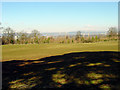
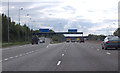
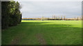
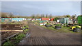
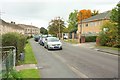
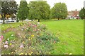
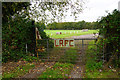
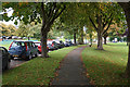
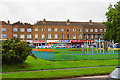
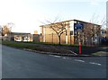
Photos of BS11 0SU


Area Information
BS11 0SU lies within the Avonmouth and Lawrence Weston electoral ward in Bristol, a small residential cluster near Avonmouth docks. This area, spanning 2.2 hectares, is home to 1,673 people, with a population density of 1,586 per square kilometre. Its history dates to the post-war era, when council housing transformed a rural hamlet into a densely populated estate. Today, it sits on the city’s northwestern fringe, bordered by Blaise Castle Estate to the east and the Severn flood plain to the west. The community is shaped by its proximity to industrial heritage, with Avonmouth’s docks and historic factories still casting a shadow. Yet, it also offers green spaces like Blaise Castle’s woods and the restored Georgian Kings Weston House. Despite challenges like past deprivation and crime, residents describe a close-knit atmosphere. Recent community initiatives, such as the Ambition Lawrence Weston project, aim to improve housing, youth facilities, and local amenities. For those seeking a pragmatic, no-nonsense lifestyle near Bristol’s industrial heart, this area provides a distinct blend of practicality and historical character.
- Area Type
- Postcode
- Area Size
- 2.2 hectares
- Population
- 1673
- Population Density
- 1586 people/km²
BS11 0SU is a small area with a housing stock primarily composed of houses, reflecting its origins as a post-war council housing estate. With 52% of homes owner-occupied, the market is a mix of private and rental properties, though the exact proportion of rentals is not specified. The limited area size means the housing stock is concentrated, with few new developments in recent decades. For buyers, this presents both opportunities and constraints. The predominance of houses suggests a focus on family homes, though the small footprint of the area means competition for properties is likely. Proximity to Avonmouth’s industrial infrastructure may influence property values, with potential for appreciation if regeneration efforts like the Ambition Lawrence Weston project succeed. Buyers should consider the area’s practicality for those prioritising affordability over luxury, given its historical association with modest housing.
House Prices in BS11 0SU
Showing 1 properties
| Address | Type | Beds | Baths | Last Sale Price | Last Sale Date | |
|---|---|---|---|---|---|---|
| Tennis 128M From St Bedes Rc School, Long Cross 141M From Long Cross, Long Cross, Lawrence Weston, Bristol, BS11 0SU | Leisure | - | - | - | - |
Energy Efficiency in BS11 0SU
BS11 0SU offers a range of amenities within practical reach. Retail options include Lidl Lawrence, Co-op Lawrence, and Morrisons Daily, catering to daily needs. The area’s transport links connect residents to Bristol’s cultural and commercial hubs, while nearby Blaise Castle Estate provides green space for leisure. Historic sites like Kings Weston House and its parkland add character, and the Lawrence Weston Community Hub offers local facilities. The mix of practical retail, transport, and green spaces supports a lifestyle that balances convenience with access to nature. However, the area’s industrial proximity may influence the types of leisure activities available, with a focus on community-driven initiatives rather than large-scale entertainment.
Amenities
Schools
BS11 0SU is served by several primary schools, including Bank Leaze Primary School, Bank Leaze Junior School, Bank Leaze Infant School, and St Bede’s Catholic College (primary). A fifth school, St Bede’s Catholic College, is an academy with a good Ofsted rating, offering a broader educational focus. The presence of multiple primary schools ensures options for young families, while the academy’s good rating indicates a commitment to quality education. However, no secondary schools are listed in the data, which may require students to commute to nearby areas. The mix of school types reflects the community’s emphasis on accessible, locally based education, though parents should plan for secondary schooling elsewhere.
| Rank | School | Type | Entry gender | Ages |
|---|
Explore more schools in this area
Go to Schools tabDemographics
The median age in BS11 0SU is 47, with the most common age range being adults aged 30–64. This suggests a community with a strong working-age population, though the area also has a higher-than-average proportion of young people and families. Home ownership stands at 52%, with houses being the predominant accommodation type. The predominant ethnic group is White, reflecting the area’s historical roots as a post-war council housing estate. The population density of 1,586 people per square kilometre indicates a compact, residential environment. While the data does not specify deprivation levels, the area’s history of social challenges—such as closures of libraries and pubs—suggests a need for ongoing investment in public services. However, initiatives like the Lawrence Weston Community Hub demonstrate local efforts to address these issues. For buyers, the demographic profile highlights a stable, family-oriented community with a focus on practical living.
Household Size
Accommodation Type
Tenure
Ethnic Group
Religion
Household Composition
Age
Household Deprivation
NS-SEC
Explore more demographic insights in this area
Go to Demographics tabPlanning
Planning Constraints
- Flood RiskPremium
- Ramsar Wetland SitesPremium
- Area of Outstanding Natural BeautyPremium
- Protected Nature ReservePremium
- Protected WoodlandPremium