Area Overview for BS11 0ST
Photos of BS11 0ST

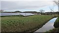
41 photos from this area
Area Information
Key information about the BS11 0ST including its size, population, and administrative classification.
- Area Type
- Postcode
- Area Size
- 19.5 hectares
- Population
- 1673
- Population Density
- 1586 people/km²
House Prices in BS11 0ST
8
Properties
£152,760
Average Sold Price
£40,800
Lowest Price
£250,000
Highest Price
Showing 8 properties
| Address | Type | Beds | Baths | Last Sale Price | Last Sale Date | |
|---|---|---|---|---|---|---|
| 130 Lawrence Weston Road, Lawrence Weston, Bristol, BS11 0ST | house | - | - | £165,000 | Jun 2014 | |
| Willow Tree Cottage, Lawrence Weston Road, Lawrence Weston, Bristol, BS11 0ST | house | - | - | £250,000 | Jul 2012 | |
| 136 Lawrence Weston Road, Lawrence Weston, Bristol, BS11 0ST | Terraced | 3 | - | £98,000 | May 2011 | |
| Yew Tree Cottage, Lawrence Weston Road, Lawrence Weston, Bristol, BS11 0ST | Semi-detached | - | - | £210,000 | Mar 2006 | |
| 132 Lawrence Weston Road, Lawrence Weston, Bristol, BS11 0ST | Terraced | - | - | £40,800 | May 1999 | |
| St Bedes School House, 135 Lawrence Weston Road, Lawrence Weston, Bristol, BS11 0ST | Terraced | 3 | 2 | - | - | |
| 134 Lawrence Weston Road, Lawrence Weston, Bristol, BS11 0ST | Terraced | - | - | - | - | |
| Lawrence Rovers Football Club, Lawrence Weston Road, Lawrence Weston, Bristol, BS11 0ST | Leisure | - | - | - | - |
Energy Efficiency in BS11 0ST
Amenities
Schools
| Rank | School | Type | Entry gender | Ages |
|---|
Explore more schools in this area
Go to Schools tabDemographics
Household Size
Family (3-5 people)
most common
Accommodation Type
Houses
most common
Tenure
52
majority
Ethnic Group
White
most common
Religion
N/A
most common
Household Composition
N/A
most common
Age
47
median
Adults (30-64 years)
most common
Household Deprivation
N/A
with no deprivation
NS-SEC
19
in Lower managerial occupations
Explore more demographic insights in this area
Go to Demographics tabPlanning
Planning Constraints
- Flood RiskPremium
- Ramsar Wetland SitesPremium
- Area of Outstanding Natural BeautyPremium
- Protected Nature ReservePremium
- Protected WoodlandPremium