Area Overview for SO31 7GT
Photos of SO31 7GT
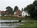
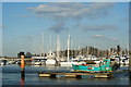
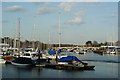
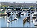
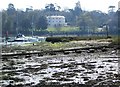
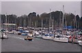
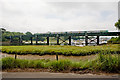

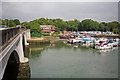
100 photos from this area
Area Information
Key information about the SO31 7GT including its size, population, and administrative classification.
- Area Type
- Postcode
- Area Size
- 3.4 hectares
- Population
- 1712
- Population Density
- 643 people/km²
House Prices in SO31 7GT
75
Properties
£293,411
Average Sold Price
£73,000
Lowest Price
£705,000
Highest Price
Showing 75 properties
| Address | Type | Beds | Baths | Last Sale Price | Last Sale Date | |
|---|---|---|---|---|---|---|
| 281 Swanwick Lane, Swanwick, SO31 7GT | house | - | - | £265,000 | Mar 2024 | |
| 291 Swanwick Lane, Swanwick, SO31 7GT | Cottage | 2 | 1 | £330,000 | Jul 2023 | |
| 286 Swanwick Lane, Swanwick, SO31 7GT | Semi-detached | 3 | 1 | £405,000 | Jun 2023 | |
| 295 Swanwick Lane, Swanwick, SO31 7GT | house | 2 | 1 | £275,000 | Feb 2023 | |
| 223 Swanwick Lane, Swanwick, SO31 7GT | Retail | 4 | 2 | £700,000 | Feb 2022 | |
| 231 Swanwick Lane, Swanwick, SO31 7GT | Flat | - | - | £110,000 | Feb 2022 | |
| 224 Swanwick Lane, Swanwick, SO31 7GT | Semi-detached | 4 | 2 | £500,000 | Jan 2022 | |
| 297 Swanwick Lane, Swanwick, SO31 7GT | house | - | - | £278,000 | Nov 2021 | |
| 284 Swanwick Lane, Swanwick, SO31 7GT | house | 3 | - | £370,000 | Oct 2021 | |
| 272 Swanwick Lane, Swanwick, SO31 7GT | Semi-detached | - | - | £320,000 | Aug 2021 |
Page 1 of 8
Energy Efficiency in SO31 7GT
Amenities
Schools
| Rank | School | Type | Entry gender | Ages |
|---|
Explore more schools in this area
Go to Schools tabDemographics
Household Size
Two person
most common
Accommodation Type
Houses
most common
Tenure
86
majority
Ethnic Group
White
most common
Religion
N/A
most common
Household Composition
N/A
most common
Age
47
median
Adults (30-64 years)
most common
Household Deprivation
N/A
with no deprivation
NS-SEC
51
in Lower managerial occupations
Explore more demographic insights in this area
Go to Demographics tabPlanning
Planning Constraints
- Flood RiskPremium
- Ramsar Wetland SitesPremium
- Area of Outstanding Natural BeautyPremium
- Protected Nature ReservePremium
- Protected WoodlandPremium