Area Overview for SO31 7HG
Photos of SO31 7HG
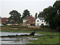
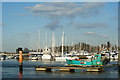
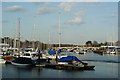
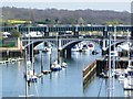
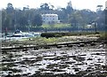
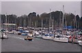
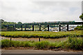
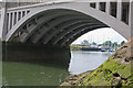
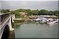
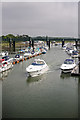
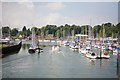
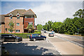
100 photos from this area
Area Information
Key information about the SO31 7HG including its size, population, and administrative classification.
- Area Type
- Postcode
- Area Size
- 9721 m²
- Population
- 1712
- Population Density
- 643 people/km²
House Prices in SO31 7HG
21
Properties
£219,800
Average Sold Price
£29,200
Lowest Price
£355,000
Highest Price
Showing 21 properties
| Address | Type | Beds | Baths | Last Sale Price | Last Sale Date | |
|---|---|---|---|---|---|---|
| 35 Lower Swanwick Road, Swanwick, SO31 7HG | Terraced | 3 | 1 | £300,000 | Mar 2023 | |
| 33 Lower Swanwick Road, Swanwick, SO31 7HG | Terraced | 3 | 1 | £315,000 | Feb 2023 | |
| 31 Lower Swanwick Road, Swanwick, SO31 7HG | Detached | 3 | 1 | £355,000 | Jul 2020 | |
| 1 Lower Swanwick Road, Swanwick, SO31 7HG | Detached | 3 | 1 | £335,000 | Jul 2020 | |
| 19 Lower Swanwick Road, Swanwick, SO31 7HG | Terraced | 3 | 1 | £310,000 | Aug 2017 | |
| 15 Lower Swanwick Road, Swanwick, SO31 7HG | Terraced | 3 | 1 | £216,000 | Jul 2015 | |
| 21 Lower Swanwick Road, Swanwick, SO31 7HG | Detached | 3 | - | £250,000 | Oct 2012 | |
| 41 Lower Swanwick Road, Swanwick, SO31 7HG | Terraced | 3 | 1 | £150,000 | Jul 2009 | |
| 11 Lower Swanwick Road, Swanwick, SO31 7HG | Terraced | - | - | £193,000 | Mar 2008 | |
| 5 Lower Swanwick Road, Swanwick, SO31 7HG | Detached | - | - | £268,000 | Oct 2007 |
Page 1 of 3
Energy Efficiency in SO31 7HG
Amenities
Schools
| Rank | School | Type | Entry gender | Ages |
|---|
Explore more schools in this area
Go to Schools tabDemographics
Household Size
Two person
most common
Accommodation Type
Houses
most common
Tenure
86
majority
Ethnic Group
White
most common
Religion
N/A
most common
Household Composition
N/A
most common
Age
47
median
Adults (30-64 years)
most common
Household Deprivation
N/A
with no deprivation
NS-SEC
51
in Lower managerial occupations
Explore more demographic insights in this area
Go to Demographics tabPlanning
Planning Constraints
- Flood RiskPremium
- Ramsar Wetland SitesPremium
- Area of Outstanding Natural BeautyPremium
- Protected Nature ReservePremium
- Protected WoodlandPremium