Area Overview for SO31 7JH
Photos of SO31 7JH
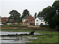
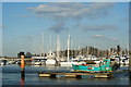
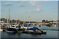
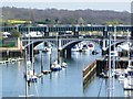
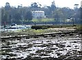
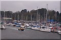
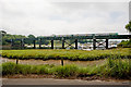

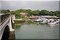
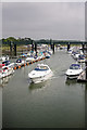
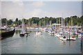
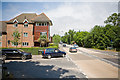
100 photos from this area
Area Information
Key information about the SO31 7JH including its size, population, and administrative classification.
- Area Type
- Postcode
- Area Size
- 2.3 hectares
- Population
- 1712
- Population Density
- 643 people/km²
House Prices in SO31 7JH
35
Properties
£308,914
Average Sold Price
£90,500
Lowest Price
£600,000
Highest Price
Showing 35 properties
| Address | Type | Beds | Baths | Last Sale Price | Last Sale Date | |
|---|---|---|---|---|---|---|
| 43 Anglers Way, Lower Swanwick, SO31 7JH | Detached | 4 | 2 | £560,000 | Aug 2025 | |
| 33 Anglers Way, Lower Swanwick, SO31 7JH | Detached | 3 | 2 | £490,000 | Nov 2024 | |
| 28 Anglers Way, Lower Swanwick, SO31 7JH | Detached | 4 | 2 | £580,000 | Oct 2024 | |
| 36 Anglers Way, Lower Swanwick, SO31 7JH | Detached | 4 | 2 | £600,000 | Feb 2024 | |
| 14 Anglers Way, Lower Swanwick, SO31 7JH | Detached | 4 | - | £490,000 | Sep 2021 | |
| 31 Anglers Way, Lower Swanwick, SO31 7JH | Detached | 3 | 2 | £400,000 | Jun 2021 | |
| 4 Anglers Way, Lower Swanwick, SO31 7JH | Detached | 4 | 2 | £522,500 | Aug 2020 | |
| 23 Anglers Way, Lower Swanwick, SO31 7JH | Detached | 4 | 2 | £475,000 | Aug 2019 | |
| 25 Anglers Way, Lower Swanwick, SO31 7JH | house | - | - | £440,000 | Aug 2019 | |
| 35 Anglers Way, Lower Swanwick, SO31 7JH | Detached | 4 | 3 | £490,000 | Dec 2016 |
Page 1 of 4
Energy Efficiency in SO31 7JH
Amenities
Schools
| Rank | School | Type | Entry gender | Ages |
|---|
Explore more schools in this area
Go to Schools tabDemographics
Household Size
Two person
most common
Accommodation Type
Houses
most common
Tenure
86
majority
Ethnic Group
White
most common
Religion
N/A
most common
Household Composition
N/A
most common
Age
47
median
Adults (30-64 years)
most common
Household Deprivation
N/A
with no deprivation
NS-SEC
51
in Lower managerial occupations
Explore more demographic insights in this area
Go to Demographics tabPlanning
Planning Constraints
- Flood RiskPremium
- Ramsar Wetland SitesPremium
- Area of Outstanding Natural BeautyPremium
- Protected Nature ReservePremium
- Protected WoodlandPremium