Area Overview for SO31 7GS
Photos of SO31 7GS
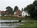
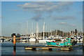
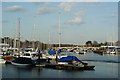
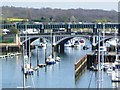
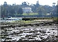
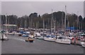
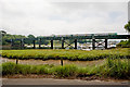

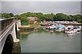
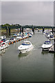
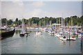
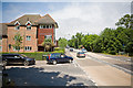
100 photos from this area
Area Information
Key information about the SO31 7GS including its size, population, and administrative classification.
- Area Type
- Postcode
- Area Size
- 1.2 hectares
- Population
- 1712
- Population Density
- 643 people/km²
House Prices in SO31 7GS
33
Properties
£350,830
Average Sold Price
£40,000
Lowest Price
£570,000
Highest Price
Showing 33 properties
| Address | Type | Beds | Baths | Last Sale Price | Last Sale Date | |
|---|---|---|---|---|---|---|
| 323 Old Swanwick Lane, Lower Swanwick, Southampton, SO31 7GS | Detached | 4 | 1 | £570,000 | Aug 2025 | |
| 314 Old Swanwick Lane, Lower Swanwick, Southampton, SO31 7GS | Detached | 3 | 1 | £500,000 | Aug 2023 | |
| 298 Old Swanwick Lane, Lower Swanwick, Southampton, SO31 7GS | Semi-detached | 3 | 2 | £480,000 | Jul 2023 | |
| 329 Old Swanwick Lane, Lower Swanwick, Southampton, SO31 7GS | Detached | 4 | 2 | £429,500 | Jun 2021 | |
| 306 Old Swanwick Lane, Lower Swanwick, Southampton, SO31 7GS | Semi-detached | 2 | 1 | £323,000 | Oct 2020 | |
| 325 Old Swanwick Lane, Lower Swanwick, Southampton, SO31 7GS | house | 4 | - | £460,000 | Sep 2019 | |
| 292 Old Swanwick Lane, Lower Swanwick, Southampton, SO31 7GS | Cottage | 2 | 1 | £300,000 | Sep 2019 | |
| 327 Old Swanwick Lane, Lower Swanwick, Southampton, SO31 7GS | Detached | 4 | - | £440,000 | Jun 2017 | |
| 321 Old Swanwick Lane, Lower Swanwick, Southampton, SO31 7GS | house | - | - | £470,000 | Apr 2017 | |
| 308 Old Swanwick Lane, Lower Swanwick, Southampton, SO31 7GS | house | - | - | £380,000 | Jan 2016 |
Page 1 of 4
Energy Efficiency in SO31 7GS
Amenities
Schools
| Rank | School | Type | Entry gender | Ages |
|---|
Explore more schools in this area
Go to Schools tabDemographics
Household Size
Two person
most common
Accommodation Type
Houses
most common
Tenure
86
majority
Ethnic Group
White
most common
Religion
N/A
most common
Household Composition
N/A
most common
Age
47
median
Adults (30-64 years)
most common
Household Deprivation
N/A
with no deprivation
NS-SEC
51
in Lower managerial occupations
Explore more demographic insights in this area
Go to Demographics tabPlanning
Planning Constraints
- Flood RiskPremium
- Ramsar Wetland SitesPremium
- Area of Outstanding Natural BeautyPremium
- Protected Nature ReservePremium
- Protected WoodlandPremium