Area Overview for RG2 8RE
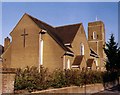
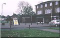
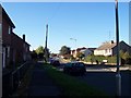
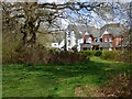
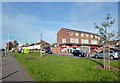
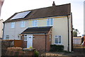
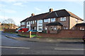
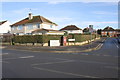
Photos of RG2 8RE
Area Information
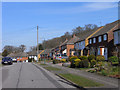
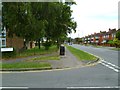
RG2 8RE is a compact postcode area in England, covering just 1430 m² and home to 1427 residents. Its high population density of 997,679 people per km² reflects its small, tightly knit character. This is a residential cluster where daily life revolves around proximity to amenities and community ties. The area’s maturity is evident in its median age of 47, with most residents falling between 30 and 64 years old. While the data does not specify the exact balance of families versus individuals, the presence of schools and retail hubs suggests a mix of household types. Living here means navigating a dense, urban environment with limited green space, but with easy access to rail links and essential services. The area’s small size means residents are likely to know their neighbours, though the high density may impact privacy. For those seeking a compact, amenity-rich environment, RG2 8RE offers a blend of practicality and convenience, though its size limits expansion or new development.
- Area Type
- Postcode
- Area Size
- 1430 m²
- Population
- 1427
- Population Density
- 5609 people/km²
The property market in RG2 8RE is characterised by a low home ownership rate of 36%, suggesting that the area is more rental-focused than owner-occupied. This aligns with the accommodation type data, which lists houses as the predominant housing stock. Given the postcode’s small size and high population density, the housing stock is likely limited, with properties concentrated in a compact area. For buyers, this means competition for available homes, particularly as the area’s proximity to schools and transport links may make it attractive to families or commuters. However, the lack of data on property prices or development plans means buyers should consider the area’s constraints, such as limited expansion potential and the need for proximity to amenities. The predominance of houses may appeal to those seeking larger living spaces, but the high density could impact privacy or outdoor space.
House Prices in RG2 8RE
Showing 3 properties
| Address | Type | Beds | Baths | Last Sale Price | Last Sale Date | |
|---|---|---|---|---|---|---|
| 6 Blandford Road, Reading, RG2 8RE | Terraced | - | - | £86,500 | Apr 1999 | |
| 4 Blandford Road, Reading, RG2 8RE | Terraced | - | - | - | - | |
| 8 Blandford Road, Reading, RG2 8RE | house | - | - | - | - |
Energy Efficiency in RG2 8RE
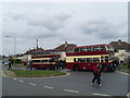
Residents of RG2 8RE have access to a range of retail and transport amenities within easy reach. Local shops include Lidl Whitley, Co-op Whitley, and Aldi Unit 6 Gateway Retail Park, providing everyday shopping options. The proximity to multiple rail stations—Earley, Reading West, and Reading—enhances connectivity, making it simple to travel to nearby destinations. While the area lacks explicit details on parks or leisure facilities, the presence of retail and transport hubs suggests a focus on practicality over expansive recreational spaces. The compact nature of the postcode means amenities are concentrated, which can be convenient for daily errands but may limit options for those seeking larger green spaces or cultural venues. For buyers, the lifestyle here is defined by proximity to essentials, though the high population density may mean a more urban, less sprawling environment compared to other areas.
Amenities
Schools
Residents of RG2 8RE have access to a range of educational institutions, including Christ The King Catholic Primary School, which holds a ‘good’ Ofsted rating, and Thamesbridge College, a primary school. Two instances of John Madejski Academy are listed, though the data does not clarify if they are separate entities or duplicates. The presence of both primary schools and an academy suggests a mix of educational approaches, with the academy potentially offering specialist or alternative curricula. For families, this variety could provide options depending on their priorities, such as faith-based education or specific academic focus. However, the lack of secondary school data means buyers should investigate further if their child requires a comprehensive school. The proximity of these institutions to RG2 8RE highlights the area’s suitability for households with children, though the high population density may affect school capacity or catchment areas.
| Rank | School | Type | Entry gender | Ages |
|---|
Explore more schools in this area
Go to Schools tabDemographics
The community in RG2 8RE is predominantly composed of adults aged 30–64, with a median age of 47. This suggests a mature, stable population, likely with established careers and families. Home ownership is relatively low at 36%, indicating that a majority of residents rent their properties. The accommodation type is primarily houses, which is unusual for a high-density area but may reflect the layout of the postcode’s small residential cluster. The predominant ethnic group is White, though no specific data on diversity or deprivation levels is provided. The high population density of 997,679 people per km² implies limited space for new housing or infrastructure, which could influence quality of life factors such as overcrowding or strain on local services. For buyers, this demographic profile suggests a community focused on stability and practical living, with a strong presence of middle-aged residents.
Household Size
Accommodation Type
Tenure
Ethnic Group
Religion
Household Composition
Age
Household Deprivation
NS-SEC
Explore more demographic insights in this area
Go to Demographics tabPlanning
Planning Constraints
- Flood RiskPremium
- Ramsar Wetland SitesPremium
- Area of Outstanding Natural BeautyPremium
- Protected Nature ReservePremium
- Protected WoodlandPremium