Area Overview for RG2 8RD
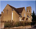
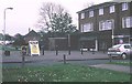
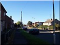
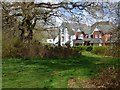
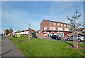
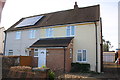
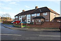
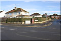
Photos of RG2 8RD
Area Information
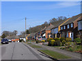
RG2 8RD is a small, tightly packed residential area in England, covering just 1,683 square metres and home to 1,427 people. Its high population density of 847,839 people per square kilometre reflects a compact, closely knit community. The area is characterised by its focus on houses, with a predominance of owner-occupied properties. While the postcode is modest in size, it offers practical access to nearby rail networks, including Earley, Reading West, and Reading stations, making commuting straightforward. Daily life here is shaped by proximity to schools like Christ The King Catholic Primary School, which holds a good Ofsted rating, and the presence of local retail options such as Lidl and Co-op. The area’s compact nature means amenities are within walking or short driving distance, though its small footprint means it is best suited for those prioritising convenience over expansive living space. With a median age of 47 and a population skewed toward adults aged 30–64, the community is stable, with a focus on family life and established neighbourhoods.
- Area Type
- Postcode
- Area Size
- 1683 m²
- Population
- 1427
- Population Density
- 5609 people/km²
The property market in RG2 8RD is defined by its focus on houses, with a home ownership rate of 36%. This suggests a mix of owner-occupied and rental properties, though the area is not dominated by either. The compact size of the postcode means the housing stock is limited, with fewer options for buyers seeking larger properties. The prevalence of single-family homes indicates a community that prioritises private, standalone living over high-density developments. For buyers, this small area may offer limited scope for expansion, but the proximity to Reading’s rail network and amenities could offset the lack of space. The low home ownership rate also implies a potential for rental demand, though the market remains niche due to the area’s size. Prospective buyers should consider the limited availability of properties and the need to evaluate the area’s long-term growth potential against its current constraints.
House Prices in RG2 8RD
Showing 3 properties
| Address | Type | Beds | Baths | Last Sale Price | Last Sale Date | |
|---|---|---|---|---|---|---|
| 2B Blandford Road, Reading, RG2 8RD | Semi-detached | - | - | - | - | |
| 2 Blandford Road, Reading, RG2 8RD | house | - | - | - | - | |
| 2A Blandford Road, Reading, RG2 8RD | Bungalow | - | - | - | - |
Energy Efficiency in RG2 8RD
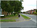
The lifestyle in RG2 8RD is shaped by its proximity to essential amenities, including retail outlets like Lidl Whitley, Co-op Whitley, and Aldi Unit 6 Gateway Retail Park. These shops provide everyday convenience, from groceries to household essentials. The area’s rail links to Reading’s stations add to its accessibility, enabling easy travel to larger urban centres for leisure, shopping, or employment. While the data does not mention parks or leisure facilities directly, the compact nature of the postcode suggests that residents may rely on nearby areas for recreational spaces. The availability of multiple retail options and rail connections contributes to a practical, community-oriented lifestyle, though the small size of the area means it is best suited for those prioritising convenience over expansive amenities.
Amenities
Schools
Residents of RG2 8RD have access to a range of educational institutions, including Christ The King Catholic Primary School, which holds a good Ofsted rating, and Thamesbridge College, another primary school. John Madejski Academy is listed twice in the data, though its type is noted as an academy. This mix of primary schools and academies provides families with options for both early education and secondary schooling. The presence of a school with a good Ofsted rating suggests at least one institution delivering quality education, though the overall diversity of school types may be limited. For families prioritising academic standards, the Christ The King Catholic Primary School offers a reliable choice, while the academies may provide alternative curricula or specialisms. The proximity of these schools to the area reinforces its appeal for households with children, though the limited number of options may require careful consideration of commuting distances.
| Rank | School | Type | Entry gender | Ages |
|---|
Explore more schools in this area
Go to Schools tabDemographics
The population of RG2 8RD is predominantly adults aged 30–64, with a median age of 47. This suggests a mature, settled community with a strong presence of working-age individuals. Home ownership stands at 36%, indicating a mix of owner-occupied and rental properties, though the area is not heavily reliant on the private rental market. The accommodation type is primarily houses, which is notable in a region where flats or apartments are more common. The predominant ethnic group is White, reflecting a lack of significant ethnic diversity in the area. While no specific deprivation data is available, the high population density and focus on single-family homes suggest a balance between affordability and space. The age profile implies a community with established careers and families, though the relatively low home ownership rate may indicate a higher proportion of younger professionals or those in transient employment.
Household Size
Accommodation Type
Tenure
Ethnic Group
Religion
Household Composition
Age
Household Deprivation
NS-SEC
Explore more demographic insights in this area
Go to Demographics tabPlanning
Planning Constraints
- Flood RiskPremium
- Ramsar Wetland SitesPremium
- Area of Outstanding Natural BeautyPremium
- Protected Nature ReservePremium
- Protected WoodlandPremium