Area Overview for RG2 8RG
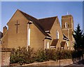
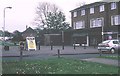
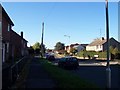
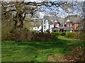
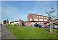
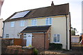
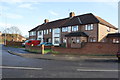
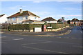
Photos of RG2 8RG
Area Information
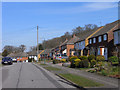
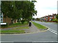
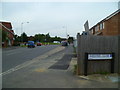
RG2 8RG is a compact residential postcode in England, covering just 7,635 square metres. Despite its small size, it is densely populated, with 1,531 residents living at a density of 200,536 people per square kilometre. This makes it a tightly knit community where proximity to amenities and services is a key feature. The area is home to a mix of adults aged 30–64, with a median age of 47, suggesting a stable population of long-term residents. Living here means being close to essential services, including retail outlets like Lidl and Co-op, as well as rail links to Reading and Earley. The area’s digital connectivity is robust, with a broadband score of 100 and a mobile coverage score of 85, ensuring reliable internet access for both work and leisure. While the crime risk is medium, with a safety score of 59, the absence of environmental constraints like protected woodlands or flood zones adds to its appeal. For buyers, RG2 8RG offers a blend of practicality and convenience, though its small size means limited space for expansion.
- Area Type
- Postcode
- Area Size
- 7635 m²
- Population
- 1531
- Population Density
- 5839 people/km²
RG2 8RG is characterised by a strong owner-occupied market, with 56% of residents owning their homes. The accommodation type is predominantly houses, which contrasts with areas where flats or apartments dominate. This suggests a housing stock that prioritises privacy and space, though the small area size of 7,635 square metres limits the number of properties available. For buyers, this means competition is likely to be high, with limited scope for new developments due to the area’s compact nature. The focus on owner-occupation indicates a stable market, with fewer rental properties available. Prospective buyers should consider the proximity to amenities and transport links, which are critical in such a densely populated area. The lack of planning constraints, such as protected woodlands or AONB designations, may also make it easier to acquire property without regulatory hurdles.
House Prices in RG2 8RG
Showing 16 properties
| Address | Type | Beds | Baths | Last Sale Price | Last Sale Date | |
|---|---|---|---|---|---|---|
| 23 Blandford Road, Reading, RG2 8RG | Semi-detached | 5 | 1 | £440,000 | Nov 2021 | |
| 47 Blandford Road, Reading, RG2 8RG | Terraced | 3 | 1 | £290,000 | Mar 2021 | |
| 37 Blandford Road, Reading, RG2 8RG | house | - | - | £280,000 | Nov 2015 | |
| 33 Blandford Road, Reading, RG2 8RG | Semi-detached | 3 | - | £230,000 | Sep 2014 | |
| 39 Blandford Road, Reading, RG2 8RG | Semi-detached | - | - | £175,000 | May 2008 | |
| 41 Blandford Road, Reading, RG2 8RG | Detached | 4 | 2 | £225,000 | Mar 2007 | |
| 41A Blandford Road, Reading, RG2 8RG | Detached | 4 | 1 | - | - | |
| 31 Blandford Road, Reading, RG2 8RG | Detached | 3 | 1 | - | - | |
| 45 Blandford Road, Reading, RG2 8RG | Terraced | - | - | - | - | |
| 35 Blandford Road, Reading, RG2 8RG | Semi-detached | - | - | - | - |
Energy Efficiency in RG2 8RG
The lifestyle in RG2 8RG is shaped by its proximity to essential amenities. Within walking distance are retail outlets such as Lidl Whitley, Co-op Whitley, and Aldi Unit 6 Gateway Retail Park, offering a range of grocery and household goods. The rail network, with stations like Reading West and Earley, connects residents to nearby towns and cities, enhancing mobility. While the area lacks large parks or leisure facilities, the compact nature of the postcode means amenities are closely clustered, reducing the need for long journeys. The presence of two primary schools and reliable transport links suggests a focus on convenience for families. However, the absence of larger recreational spaces may be a limitation for those seeking outdoor activities. Overall, daily life here is efficient, with services and transport options readily accessible.
Amenities
Schools
Residents of RG2 8RG have access to two primary schools within practical reach: Geoffrey Field Junior School and Geoffrey Field Infant School. Both are Ofsted-rated, with the latter achieving an outstanding rating. This combination of schools provides a seamless transition for children from early years through to primary education. The presence of two schools in close proximity reduces the need for long commutes, which is a key consideration for families. The high standard of education, particularly the outstanding rating at the infant school, may appeal to parents seeking quality schooling. However, the absence of secondary schools in the immediate area means families may need to look further afield for secondary education. The schools’ proximity to residential areas underscores the area’s appeal as a family-friendly location.
| Rank | School | Type | Entry gender | Ages |
|---|
Explore more schools in this area
Go to Schools tabDemographics
The community in RG2 8RG is predominantly composed of adults aged 30–64, making up the most common age range. With a median age of 47, the population skews older than the national average, suggesting a mix of established families and retirees. Home ownership is strong, with 56% of residents owning their homes, compared to 44% renting. The accommodation types are primarily houses, reflecting a preference for private, detached living. The predominant ethnic group is White, which aligns with broader regional trends. The high population density—200,536 people per square kilometre—means the area is intensely populated, though this does not necessarily correlate with deprivation. The absence of specific deprivation data means it is unclear how this density affects quality of life, but the presence of schools, retail, and transport links suggests a well-served community.
Household Size
Accommodation Type
Tenure
Ethnic Group
Religion
Household Composition
Age
Household Deprivation
NS-SEC
Explore more demographic insights in this area
Go to Demographics tabPlanning
Planning Constraints
- Flood RiskPremium
- Ramsar Wetland SitesPremium
- Area of Outstanding Natural BeautyPremium
- Protected Nature ReservePremium
- Protected WoodlandPremium