Area Overview for RG2 8RP
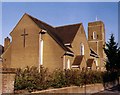
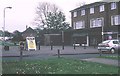
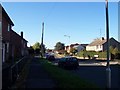
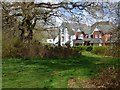
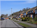
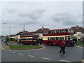
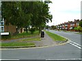
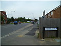
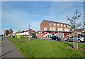
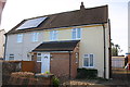
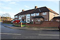
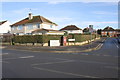
Photos of RG2 8RP
Area Information
RG2 8RP is a small, densely populated residential area in England, covering just 2,967 square metres and home to 1,531 residents. Its compact size means it is a tightly knit community, with a high population density of 516,066 people per square kilometre. This area is characterised by its focus on family living, with a median age of 47 and a majority of residents aged 30–64. The presence of two primary schools, Geoffrey Field Infant and Junior Schools, suggests a strong local focus on education. Proximity to rail stations such as Reading and Earley ensures easy access to nearby cities, while nearby retail outlets like Lidl and Co-op provide daily convenience. The area’s mix of residential housing and practical amenities makes it appealing for those seeking a balanced lifestyle, though its small size means it is best suited for those prioritising proximity to services over expansive living spaces.
- Area Type
- Postcode
- Area Size
- 2967 m²
- Population
- 1531
- Population Density
- 5839 people/km²
The property market in RG2 8RP is dominated by owner-occupied homes, with 56% of residents owning their properties. The accommodation type is primarily houses, which suggests a focus on family-friendly housing stock. Given the area’s small size and high population density, the housing stock is likely limited, making it a niche market for buyers seeking proximity to local amenities. The presence of nearby rail stations and schools may drive demand, but the area’s compact nature means buyers should consider nearby zones for more options. The high proportion of owner-occupiers indicates a stable market, though the limited number of properties could lead to competition among buyers. For those prioritising convenience over space, RG2 8RP offers a practical, if constrained, housing environment.
House Prices in RG2 8RP
Showing 7 properties
| Address | Type | Beds | Baths | Last Sale Price | Last Sale Date | |
|---|---|---|---|---|---|---|
| 59 Blandford Road, Reading, RG2 8RP | Semi-detached | 3 | 1 | £315,000 | Jan 2020 | |
| 55 Blandford Road, Reading, RG2 8RP | Terraced | 3 | 2 | £235,000 | Apr 2015 | |
| 61 Blandford Road, Reading, RG2 8RP | Semi-detached | 3 | - | £180,000 | Aug 2011 | |
| 63 Blandford Road, Reading, RG2 8RP | house | - | - | £49,950 | Apr 1996 | |
| 51 Blandford Road, Reading, RG2 8RP | Terraced | 3 | 2 | - | - | |
| 53 Blandford Road, Reading, RG2 8RP | Terraced | - | - | - | - | |
| 57 Blandford Road, Reading, RG2 8RP | Semi-detached | - | - | - | - |
Energy Efficiency in RG2 8RP
Daily life in RG2 8RP is shaped by its proximity to essential amenities. The area includes five retail outlets, such as Lidl Whitley, Co-op Whitley, and Aldi Unit 6 Gateway Retail Park, offering convenient shopping options. These stores cater to everyday needs, reducing the need for long trips. The rail network, with stations like Reading and Earley, connects residents to broader regional opportunities. While the data does not specify parks or leisure facilities, the presence of schools and retail suggests a focus on practicality over expansive recreational spaces. The area’s compact nature ensures that amenities are within walking or short driving distance, fostering a lifestyle that prioritises accessibility and convenience.
Amenities
Schools
Residents of RG2 8RP have access to two primary schools: Geoffrey Field Infant School and Geoffrey Field Junior School. Both institutions are highly rated, with the infant school receiving an Ofsted rating of outstanding and the junior school rated good. This combination ensures a seamless educational pathway for children from early years through to primary school. The presence of both school types within the area reduces the need for long commutes, supporting families who value local schooling. The high Ofsted ratings suggest strong academic performance and quality teaching, which are critical factors for parents. While secondary education options are not specified in the data, the proximity of these schools to residential areas indicates a community prioritising educational infrastructure.
| Rank | School | Type | Entry gender | Ages |
|---|
Explore more schools in this area
Go to Schools tabDemographics
The community in RG2 8RP is predominantly middle-aged, with a median age of 47 and 56% of residents owning their homes. The area is composed largely of houses, reflecting a stable, long-term demographic. Over 80% of the population falls within the 30–64 age range, indicating a strong presence of working-age adults and families. The predominant ethnic group is White, which aligns with broader regional trends. The high population density—516,066 people per square kilometre—suggests a compact, possibly urbanised environment, though the area’s small size means it is not a sprawling suburb. This density may influence the character of daily life, with shared spaces and communal amenities playing a central role. The data does not indicate significant deprivation, but the high density could impact availability of private outdoor space.
Household Size
Accommodation Type
Tenure
Ethnic Group
Religion
Household Composition
Age
Household Deprivation
NS-SEC
Explore more demographic insights in this area
Go to Demographics tabPlanning
Planning Constraints
- Flood RiskPremium
- Ramsar Wetland SitesPremium
- Area of Outstanding Natural BeautyPremium
- Protected Nature ReservePremium
- Protected WoodlandPremium