Area Overview for PO16 7UB
Photos of PO16 7UB
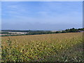
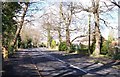
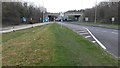
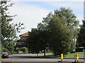
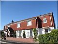
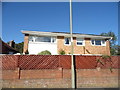
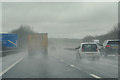
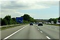
64 photos from this area
Area Information
Key information about the PO16 7UB including its size, population, and administrative classification.
- Area Type
- Postcode
- Area Size
- 1.7 hectares
- Population
- 1292
- Population Density
- 2314 people/km²
House Prices in PO16 7UB
19
Properties
£420,336
Average Sold Price
£144,750
Lowest Price
£790,000
Highest Price
Showing 19 properties
| Address | Type | Beds | Baths | Last Sale Price | Last Sale Date | |
|---|---|---|---|---|---|---|
| 24 Kiln Road, Fareham, PO16 7UB | Detached | 2 | 1 | £415,000 | Nov 2025 | |
| 16 Kiln Road, Fareham, PO16 7UB | house | - | - | £450,000 | Jun 2021 | |
| 36 Kiln Road, Fareham, PO16 7UB | house | - | - | £610,000 | Nov 2020 | |
| 28 Kiln Road, Fareham, PO16 7UB | house | 5 | - | £582,000 | Nov 2019 | |
| 8 Kiln Road, Fareham, PO16 7UB | house | 3 | - | £330,000 | Apr 2015 | |
| 14 Kiln Road, Fareham, PO16 7UB | Detached | 3 | 2 | £278,000 | Jan 2012 | |
| 34 Kiln Road, Fareham, PO16 7UB | Semi-detached | 4 | 3 | £245,000 | Jun 2011 | |
| 20 Kiln Road, Fareham, PO16 7UB | Semi-detached | 4 | 3 | £790,000 | Sep 2010 | |
| 10-12 Kiln Road, Fareham, PO16 7UB | Detached | - | - | £387,500 | May 2010 | |
| 18 Kiln Road, Fareham, PO16 7UB | Detached | - | - | £299,950 | Sep 2007 |
Page 1 of 2
Energy Efficiency in PO16 7UB
Amenities
Schools
| Rank | School | Type | Entry gender | Ages |
|---|
Explore more schools in this area
Go to Schools tabDemographics
Household Size
Two person
most common
Accommodation Type
Houses
most common
Tenure
95
majority
Ethnic Group
White
most common
Religion
N/A
most common
Household Composition
N/A
most common
Age
47
median
Adults (30-64 years)
most common
Household Deprivation
N/A
with no deprivation
NS-SEC
48
in Lower managerial occupations
Explore more demographic insights in this area
Go to Demographics tabPlanning
Planning Constraints
- Flood RiskPremium
- Ramsar Wetland SitesPremium
- Area of Outstanding Natural BeautyPremium
- Protected Nature ReservePremium
- Protected WoodlandPremium