Area Overview for PO16 7HN
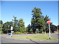
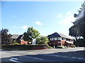
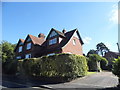
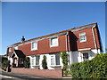
Photos of PO16 7HN


Area Information
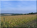
Living in PO16 7HN means residing within a very compact residential cluster. This postcode covers just 4,742 square metres and supports a population of 1,492 people. The area is located in Hampshire, England, where space is premium but local facilities remain accessible. You are part of a tightly defined neighbourhood where every street likely serves multiple neighbours. Daily life is characterised by proximity; residents rarely travel far for essential services because shops, rail stations, and ferry terminals are all within practical reach. The small footprint means you live closer to your neighbours than in many other UK locations. You will likely know your immediate surroundings better than any large suburb. This setting offers a distinct pace of life that balances the convenience of nearby transport links with the intimacy of a small residential pocket. If you prefer an atmosphere where you can walk to the supermarket or catch a train to Portsmouth without driving, PO16 7HN delivers that convenience directly to your doorstep.
- Area Type
- Postcode
- Area Size
- 4742 m²
- Population
- 1492
- Population Density
- 228 people/km²
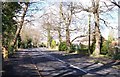
The property market in PO16 7HN is almost exclusively driven by owner-occupiers. Statistics show that 84% of homes are owned, leaving only a small fraction available for private rental. This indicates a stable market where buyers typically move in to settle rather than look for short-term leases. Houses make up the primary accommodation type, meaning you will not find many flats or purpose-built apartments. The stock consists largely of existing residential properties that have been lived in for significant periods. For buyers searching for homes in PO16 7HN, the selection will reflect this traditional character. You should look for brick or stone-built houses rather than modern conversion flats. The high ownership rate suggests that when properties do become available, they often come after long tenures. This market structure supports a community where people have invested in maintaining their residences. If you seek a quiet, leafy street with individual family homes, the housing stock here aligns with those expectations.
House Prices in PO16 7HN
Showing 15 properties
| Address | Type | Beds | Baths | Last Sale Price | Last Sale Date | |
|---|---|---|---|---|---|---|
| 3 North Hill, Fareham, PO16 7HN | house | - | - | £265,000 | Mar 2023 | |
| 13 North Hill, Fareham, PO16 7HN | Detached | 2 | 1 | £225,000 | Apr 2021 | |
| 9 North Hill, Fareham, PO16 7HN | Cottage | 2 | 1 | £220,000 | Dec 2020 | |
| 23 North Hill, Fareham, PO16 7HN | house | 2 | - | £220,000 | Sep 2019 | |
| 11 North Hill, Fareham, PO16 7HN | house | - | - | £239,178 | Aug 2019 | |
| 5 North Hill, Fareham, PO16 7HN | Terraced | 2 | 1 | £220,000 | Jan 2019 | |
| 1 North Hill, Fareham, PO16 7HN | Retail | 2 | 1 | £232,000 | Apr 2015 | |
| 15 North Hill, Fareham, PO16 7HN | house | - | - | £175,000 | Sep 1997 | |
| 21 North Hill, Fareham, PO16 7HN | Detached | 2 | 1 | £58,000 | Aug 1996 | |
| 19 North Hill, Fareham, PO16 7HN | Detached | 4 | - | - | - |
Energy Efficiency in PO16 7HN
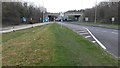
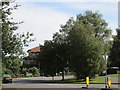
Residents of PO16 7HN enjoy a wide range of amenities within practical reach. Local retail options include a Spar, Sainsburys Broadcut, and Morrisons Daily Fareham 107. These supermarkets provide everything from fresh produce to household essentials without the need for long drives. Transport links are exceptionally convenient as you have access to five nearby rail stations including Fareham, Portchester, and Swanwick Railway Stations. Waiting room facilities and frequent services will take you to larger hubs quickly. Beyond the coast, five major ferries serve Portsmouth International Cruise and Ferry Terminal, Warsash Ferry Landing, and Gosport Ferry Terminal. These vessels connect you to the Isle of Wight and mainland ports. You can order groceries from nearby stores and board a train for work or leisure with minimal travel time. The combination of supermarkets and transport hubs creates a self-sufficient local environment. Dining and leisure pursuits are grouped tightly around these core facilities. Your daily routine benefits from the density of these services.
Amenities
Schools
Families considering moving to PO16 7HN have access to specific educational institutions nearby. The most notable option listed is Boundary Oak School, which operates as an independent school. Because the data does not provide Ofsted ratings for these institutions, assessments are based on the school type and name alone. The presence of an independent school implies an alternative to the state system that may cater to different educational philosophies or fee-based entry. You have the opportunity to enquire about the curriculum and ethos of Boundary Oak School directly. The limited number of listed schools suggests a reliance on specific providers rather than a broad mix of comprehensive academies. Parents often look beyond the immediate vicinity for comprehensive options if they do not choose independent education. The existence of this specific school gives the area a defined educational character. You must verify transport links and admission criteria to ensure schools near PO16 7HN match your family's needs.
| Rank | School | Type | Entry gender | Ages |
|---|
Explore more schools in this area
Go to Schools tabDemographics
The community in PO16 7HN has established stability with a median age of 47 years. Adults between the ages of 30 and 64 years form the most common age range in the area. This demographic profile suggests a population that is well settled rather than transient. Home ownership is a defining feature, with 84% of residents owning their homes outright. Very few people in this postcode rent their accommodation, which creates a strong sense of local investment and permanence. Houses dominate the accommodation type landscape, indicating a traditional family-oriented housing stock rather than high-density flats or modern apartments. The predominant ethnic group is White, reflecting the area's established character. You live in a community where long-term residents are the norm. This means you join a neighbourhood where social structures have deep roots. The high ownership rate supports local schools and businesses because families stay for decades. You are buying into an area where the majority of people consider themselves permanent residents.
Household Size
Accommodation Type
Tenure
Ethnic Group
Religion
Household Composition
Age
Household Deprivation
NS-SEC
Explore more demographic insights in this area
Go to Demographics tabPlanning
Planning Constraints
- Flood RiskPremium
- Ramsar Wetland SitesPremium
- Area of Outstanding Natural BeautyPremium
- Protected Nature ReservePremium
- Protected WoodlandPremium