Area Overview for PO16 7UG
Photos of PO16 7UG

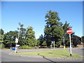
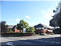
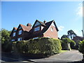
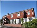
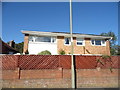


64 photos from this area
Area Information
Key information about the PO16 7UG including its size, population, and administrative classification.
- Area Type
- Postcode
- Area Size
- 3.9 hectares
- Population
- 1428
- Population Density
- 2803 people/km²
House Prices in PO16 7UG
14
Properties
£215,438
Average Sold Price
£79,000
Lowest Price
£260,000
Highest Price
Showing 14 properties
| Address | Type | Beds | Baths | Last Sale Price | Last Sale Date | |
|---|---|---|---|---|---|---|
| 50 Kiln Road, Fareham, PO16 7UG | Detached | 2 | 1 | £247,500 | Sep 2025 | |
| 52 Kiln Road, Fareham, PO16 7UG | house | - | - | £235,000 | Jun 2021 | |
| 42 Kiln Road, Fareham, PO16 7UG | house | - | - | £237,500 | Oct 2020 | |
| 58 Kiln Road, Fareham, PO16 7UG | house | - | - | £245,000 | Sep 2012 | |
| 54 Kiln Road, Fareham, PO16 7UG | Terraced | - | - | £249,500 | Sep 2007 | |
| 46 Kiln Road, Fareham, PO16 7UG | Terraced | - | - | £170,000 | Oct 2006 | |
| 56 Kiln Road, Fareham, PO16 7UG | Terraced | - | - | £79,000 | Jun 1999 | |
| 64 Kiln Road, Fareham, PO16 7UG | Detached | 5 | 3 | £260,000 | Aug 1998 | |
| 44 Kiln Road, Fareham, PO16 7UG | Terraced | - | - | - | - | |
| Kiln Lodge, 66 Kiln Road, Fareham, PO16 7UG | Retirement | - | - | - | - |
Page 1 of 2
Energy Efficiency in PO16 7UG
Amenities
Schools
| Rank | School | Type | Entry gender | Ages |
|---|
Explore more schools in this area
Go to Schools tabDemographics
Household Size
Two person
most common
Accommodation Type
Houses
most common
Tenure
89
majority
Ethnic Group
White
most common
Religion
N/A
most common
Household Composition
N/A
most common
Age
47
median
Adults (30-64 years)
most common
Household Deprivation
N/A
with no deprivation
NS-SEC
47
in Lower managerial occupations
Explore more demographic insights in this area
Go to Demographics tabPlanning
Planning Constraints
- Flood RiskPremium
- Ramsar Wetland SitesPremium
- Area of Outstanding Natural BeautyPremium
- Protected Nature ReservePremium
- Protected WoodlandPremium