Area Overview for PO16 7UQ
Photos of PO16 7UQ
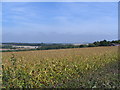
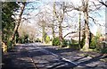
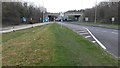
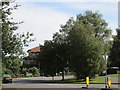
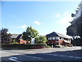
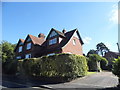
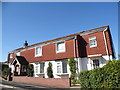
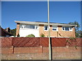
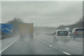
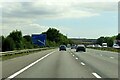
64 photos from this area
Area Information
Key information about the PO16 7UQ including its size, population, and administrative classification.
- Area Type
- Postcode
- Area Size
- 1.4 hectares
- Population
- 1292
- Population Density
- 2314 people/km²
House Prices in PO16 7UQ
9
Properties
£646,500
Average Sold Price
£442,500
Lowest Price
£815,000
Highest Price
Showing 9 properties
| Address | Type | Beds | Baths | Last Sale Price | Last Sale Date | |
|---|---|---|---|---|---|---|
| 43 Kiln Road, Fareham, PO16 7UQ | house | 4 | 3 | £800,000 | May 2023 | |
| 29 Kiln Road, Fareham, PO16 7UQ | house | - | - | £815,000 | Mar 2023 | |
| 41 Kiln Road, Fareham, PO16 7UQ | house | - | - | £450,000 | Apr 2014 | |
| 27 Kiln Road, Fareham, PO16 7UQ | house | - | - | £725,000 | Mar 2009 | |
| 31 Kiln Road, Fareham, PO16 7UQ | Detached | - | - | £442,500 | Aug 2002 | |
| Annexe, 27 Kiln Road, Fareham, PO16 7UQ | Flat | - | - | - | - | |
| Hunters Lodge Care Home, 39 Kiln Road, Fareham, PO16 7UQ | hospital_care_home | - | - | - | - | |
| 33 Kiln Road, Fareham, PO16 7UQ | Detached | - | - | - | - | |
| 35 Kiln Road, Fareham, PO16 7UQ | Detached | - | - | - | - |
Energy Efficiency in PO16 7UQ
Amenities
Schools
| Rank | School | Type | Entry gender | Ages |
|---|
Explore more schools in this area
Go to Schools tabDemographics
Household Size
Two person
most common
Accommodation Type
Houses
most common
Tenure
95
majority
Ethnic Group
White
most common
Religion
N/A
most common
Household Composition
N/A
most common
Age
47
median
Adults (30-64 years)
most common
Household Deprivation
N/A
with no deprivation
NS-SEC
48
in Lower managerial occupations
Explore more demographic insights in this area
Go to Demographics tabPlanning
Planning Constraints
- Flood RiskPremium
- Ramsar Wetland SitesPremium
- Area of Outstanding Natural BeautyPremium
- Protected Nature ReservePremium
- Protected WoodlandPremium