Area Overview for PO10 8RB
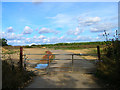
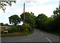
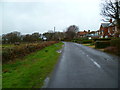
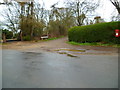
Photos of PO10 8RB


Area Information
Living in PO10 8RB offers a settled residential experience within a compact cluster of just 15.5 hectares. The area accommodates 2,395 people, resulting in a low population density of 321 inhabitants per square kilometre. This physical scale means streets are likely quieter than in larger urban centres, providing a distinct sense of space without the isolation of rural living. The postcode functions as a specific pocket within South Hants, serving as a quiet base for residents who prioritise calm over urban bustle. You will find that daily life here revolves around a close-knit community rather than large-scale commercial hubs. The housing stock is dominated by detached properties, which aligns with the low-density planning typical of this size and population. There are no major planned developments threatening the current character, as the area remains a stable residential zone. Prospective buyers should see PO10 8RB as an option for those seeking a traditional English neighbourhood where footpaths lead to local parks rather than busy shopping centres. The small size ensures that facilities are within a short drive, preventing long commutes to daily necessities.
- Area Type
- Postcode
- Area Size
- 15.5 hectares
- Population
- 2395
- Population Density
- 321 people/km²
Homes in PO10 8RB are almost exclusively houses, creating a market distinct from typical flat-heavy urban developments. The overwhelming majority of residents are owner-occupiers, with a home ownership rate standing at 69%. This statistic indicates that the local property market is driven by owners who have invested time and money into their properties rather than landlords seeking short-term rentals. Consequently, you will primarily encounter detached or semi-detached family homes available for purchase, rather than apartment blocks. The accommodation type data confirms that dwellings here are built for families rather than single-person urban living. This dominance of owner-occupied stock often leads to slower price fluctuations compared to competitive lettings markets. Buyers looking for a long-term investment should find this area appealing due to the tenure mix. The low density and focus on houses suggest that any available properties will be substantial rather than compact. This market structure appeals to those seeking stability and who do not require the convenience of flats found in city centres.
House Prices in PO10 8RB
Showing 5 properties
| Address | Type | Beds | Baths | Last Sale Price | Last Sale Date | |
|---|---|---|---|---|---|---|
| Arun Ghar, Woodmancote Lane, Woodmancote, Westbourne, PO10 8RB | Detached | 4 | 3 | £8,000 | Dec 2021 | |
| The Ranch, Woodmancote Lane, Woodmancote, Westbourne, PO10 8RB | Detached | 6 | 3 | £820,000 | Feb 2021 | |
| Five Oaks, Woodmancote Lane, Woodmancote, Westbourne, PO10 8RB | Detached | 6 | 3 | - | - | |
| Hambrook Civic Amenity Site, Marlpit Lane, Hambrook, Westbourne, PO10 8RB | Industrial | - | - | - | - | |
| The Pines, Woodmancote Lane, Woodmancote, Westbourne, PO10 8RB | Maisonette | - | - | - | - |
Energy Efficiency in PO10 8RB
Residents of PO10 8RB enjoy immediate access to key amenities without the need for long daily commuits. Retail options include Tesco Southbourne, The Southern Co-operative Co, and two other local shops, offering standard grocery provision and basic necessities nearby. Transport links are robust, with five railway stations within practical reach, including Nutbourne, Southbourne, and Emsworth Railway Station, facilitating travel to Southampton or London. Ferry crossings at Bosham Hoe and West Itchenor Landing provide direct access to coastal towns, enhancing the seaside lifestyle. Chichester/Goodwood Airport stands as the nearest airfield, providing regional connections for business or leisure travel. You will find that daily life involves a mix of local shopping and easy access to wider travel networks. The presence of multiple transport modes reduces reliance on private car ownership for all journeys. This connectivity ensures that while PO10 8RB feels secluded and quiet, it remains well-linked to the broader Hampshire economy and tourism regions.
Amenities
Schools
Westbourne Primary School is the nearest educational facility to PO10 8RB. It operates as a primary school and holds a satisfactory Ofsted rating. This rating indicates that the school meets national standards for education and care, though it may not be identified as excellent in its current inspection. Given the low population density of 321 people per square kilometre, primary education is likely the main local focus, with secondary schools requiring a longer commute. The single primary option suggests a less competitive entry point for early education compared to densely populated districts with multiple choices. Families with children in primary school age groups will have a clear, named destination for their children's daily education. The satisfactory rating provides reassurance for parents seeking a compliant institution without the pressure of highly oversubmitted excellent schools. You should verify current capacity and specific exam results through direct channels, as the dataset provides only the broad Ofsted status.
| Rank | School | Type | Entry gender | Ages |
|---|
Explore more schools in this area
Go to Schools tabDemographics
The community profile in PO10 8RB reflects a mature demographic with a median age of 47 years. The most common age range is adults aged between 30 and 64, indicating a neighbourhood populated largely by established families and long-term residents. A significant 69% of households in this postcode own their homes, suggesting a stable population with roots firmly planted in the area. Almost all residents live in houses, consistent with the broader trend of home ownership and family settlement in this region. The predominant ethnic group is White, mirroring the typical demographic makeup of traditional coastal settlements in Hampshire. You should expect a neighbourhood where long-standing connections between neighbours are common, rather than a transient population of young professionals. The age distribution implies a quieter environment during evenings, suited to those who dislike late-night noise. This demographic stability often correlates with lower crime rates and a predictable local atmosphere. There is little evidence of rapid gentrification or population turnover, which supports a consistent community feel year after year.
Household Size
Accommodation Type
Tenure
Ethnic Group
Religion
Household Composition
Age
Household Deprivation
NS-SEC
Explore more demographic insights in this area
Go to Demographics tabPlanning
Planning Constraints
- Flood RiskPremium
- Ramsar Wetland SitesPremium
- Area of Outstanding Natural BeautyPremium
- Protected Nature ReservePremium
- Protected WoodlandPremium