Area Overview for KT19 9EE
Photos of KT19 9EE
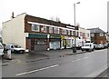
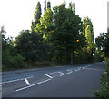
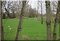
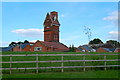
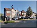
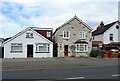
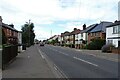
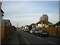
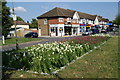
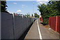
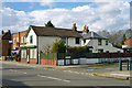
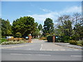
18 photos from this area
Area Information
Key information about the KT19 9EE including its size, population, and administrative classification.
- Area Type
- Postcode
- Area Size
- 8331 m²
- Population
- 1485
- Population Density
- 6837 people/km²
House Prices in KT19 9EE
31
Properties
£240,447
Average Sold Price
£52,500
Lowest Price
£422,000
Highest Price
Showing 31 properties
| Address | Type | Beds | Baths | Last Sale Price | Last Sale Date | |
|---|---|---|---|---|---|---|
| 27 Melton Place, Epsom, KT19 9EE | Semi-detached | 3 | 2 | £350,200 | Mar 2025 | |
| 15 Melton Place, Epsom, KT19 9EE | Terraced | 3 | 1 | £422,000 | Apr 2021 | |
| 22 Melton Place, Epsom, KT19 9EE | house | - | - | £405,000 | Mar 2021 | |
| 6 Melton Place, Epsom, KT19 9EE | house | 4 | 4 | £380,000 | Dec 2020 | |
| 26 Melton Place, Epsom, KT19 9EE | Terraced | 3 | - | £374,500 | Jan 2020 | |
| 12 Melton Place, Epsom, KT19 9EE | Terraced | - | - | £300,000 | Jan 2015 | |
| 4 Melton Place, Epsom, KT19 9EE | Terraced | 3 | 1 | £305,000 | Oct 2014 | |
| 10 Melton Place, Epsom, KT19 9EE | Terraced | - | - | £75,000 | Jan 2014 | |
| 21 Melton Place, Epsom, KT19 9EE | Semi-detached | 3 | 1 | £239,950 | Dec 2013 | |
| 7 Melton Place, Epsom, KT19 9EE | Flat | - | - | £189,000 | Jul 2007 |
Page 1 of 4
Energy Efficiency in KT19 9EE
Amenities
Schools
| Rank | School | Type | Entry gender | Ages |
|---|
Explore more schools in this area
Go to Schools tabDemographics
Household Size
Family (3-5 people)
most common
Accommodation Type
Houses
most common
Tenure
49
majority
Ethnic Group
White
most common
Religion
N/A
most common
Household Composition
N/A
most common
Age
47
median
Adults (30-64 years)
most common
Household Deprivation
N/A
with no deprivation
NS-SEC
28
in Lower managerial occupations
Explore more demographic insights in this area
Go to Demographics tabPlanning
Planning Constraints
- Flood RiskPremium
- Ramsar Wetland SitesPremium
- Area of Outstanding Natural BeautyPremium
- Protected Nature ReservePremium
- Protected WoodlandPremium