Area Overview for KT19 9BZ
Photos of KT19 9BZ
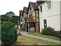
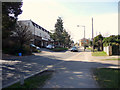
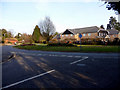

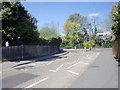
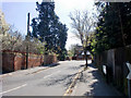
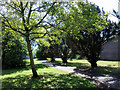


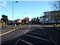
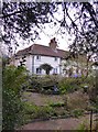

100 photos from this area
Area Information
Key information about the KT19 9BZ including its size, population, and administrative classification.
- Area Type
- Postcode
- Area Size
- 2.5 hectares
- Population
- 1485
- Population Density
- 6837 people/km²
House Prices in KT19 9BZ
63
Properties
£233,196
Average Sold Price
£47,000
Lowest Price
£468,000
Highest Price
Showing 63 properties
| Address | Type | Beds | Baths | Last Sale Price | Last Sale Date | |
|---|---|---|---|---|---|---|
| 53 Hollymoor Lane, Epsom, KT19 9BZ | Terraced | 3 | 1 | £375,000 | Sep 2024 | |
| 24 Hollymoor Lane, Epsom, KT19 9BZ | Semi-detached | 3 | 1 | £468,000 | Jan 2024 | |
| 25 Hollymoor Lane, Epsom, KT19 9BZ | Terraced | 3 | 1 | £405,000 | Jun 2023 | |
| 7 Hollymoor Lane, Epsom, KT19 9BZ | Terraced | 3 | 1 | £400,000 | Apr 2020 | |
| 31 Hollymoor Lane, Epsom, KT19 9BZ | Terraced | 3 | 1 | £382,500 | Mar 2019 | |
| 71 Hollymoor Lane, Epsom, KT19 9BZ | house | - | - | £351,500 | Jul 2018 | |
| 35 Hollymoor Lane, Epsom, KT19 9BZ | Terraced | 3 | 1 | £368,000 | Aug 2017 | |
| 67 Hollymoor Lane, Epsom, KT19 9BZ | Terraced | 3 | 2 | £301,000 | Nov 2015 | |
| 79 Hollymoor Lane, Epsom, KT19 9BZ | Semi-detached | 3 | 1 | £287,500 | Jun 2015 | |
| 33 Hollymoor Lane, Epsom, KT19 9BZ | house | - | - | £300,000 | Nov 2014 |
Page 1 of 7
Energy Efficiency in KT19 9BZ
Amenities
Schools
| Rank | School | Type | Entry gender | Ages |
|---|
Explore more schools in this area
Go to Schools tabDemographics
Household Size
Family (3-5 people)
most common
Accommodation Type
Houses
most common
Tenure
49
majority
Ethnic Group
White
most common
Religion
N/A
most common
Household Composition
N/A
most common
Age
47
median
Adults (30-64 years)
most common
Household Deprivation
N/A
with no deprivation
NS-SEC
28
in Lower managerial occupations
Explore more demographic insights in this area
Go to Demographics tabPlanning
Planning Constraints
- Flood RiskPremium
- Ramsar Wetland SitesPremium
- Area of Outstanding Natural BeautyPremium
- Protected Nature ReservePremium
- Protected WoodlandPremium