Area Overview for KT19 9EP
Photos of KT19 9EP
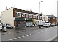
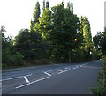
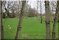
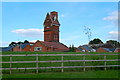
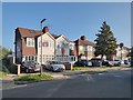
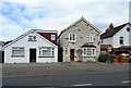
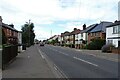
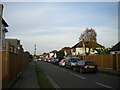
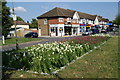
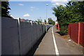
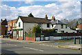
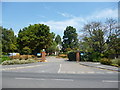
18 photos from this area
Area Information
Key information about the KT19 9EP including its size, population, and administrative classification.
- Area Type
- Postcode
- Area Size
- 1.6 hectares
- Population
- 1485
- Population Density
- 6837 people/km²
House Prices in KT19 9EP
57
Properties
£269,576
Average Sold Price
£60,000
Lowest Price
£476,000
Highest Price
Showing 57 properties
| Address | Type | Beds | Baths | Last Sale Price | Last Sale Date | |
|---|---|---|---|---|---|---|
| 34 Ormonde Avenue, Epsom, KT19 9EP | Terraced | 4 | 1 | £476,000 | Jun 2025 | |
| 48 Ormonde Avenue, Epsom, KT19 9EP | Terraced | 3 | 1 | £395,000 | Jan 2025 | |
| 37 Ormonde Avenue, Epsom, KT19 9EP | Terraced | 3 | 1 | £428,000 | Dec 2024 | |
| 23 Ormonde Avenue, Epsom, KT19 9EP | Terraced | 4 | 2 | £455,000 | Jan 2024 | |
| 49 Ormonde Avenue, Epsom, KT19 9EP | Terraced | 4 | 1 | £370,000 | Aug 2023 | |
| 19 Ormonde Avenue, Epsom, KT19 9EP | Semi-detached | 3 | 1 | £405,000 | Apr 2023 | |
| 44 Ormonde Avenue, Epsom, KT19 9EP | Terraced | 3 | 1 | £430,000 | Jul 2022 | |
| 13 Ormonde Avenue, Epsom, KT19 9EP | Terraced | 3 | 2 | £407,500 | Jan 2022 | |
| 16 Ormonde Avenue, Epsom, KT19 9EP | house | 3 | - | £375,000 | Sep 2021 | |
| 30 Ormonde Avenue, Epsom, KT19 9EP | Terraced | 3 | 1 | £350,000 | Apr 2020 |
Page 1 of 6
Energy Efficiency in KT19 9EP
Amenities
Schools
| Rank | School | Type | Entry gender | Ages |
|---|
Explore more schools in this area
Go to Schools tabDemographics
Household Size
Family (3-5 people)
most common
Accommodation Type
Houses
most common
Tenure
49
majority
Ethnic Group
White
most common
Religion
N/A
most common
Household Composition
N/A
most common
Age
47
median
Adults (30-64 years)
most common
Household Deprivation
N/A
with no deprivation
NS-SEC
28
in Lower managerial occupations
Explore more demographic insights in this area
Go to Demographics tabPlanning
Planning Constraints
- Flood RiskPremium
- Ramsar Wetland SitesPremium
- Area of Outstanding Natural BeautyPremium
- Protected Nature ReservePremium
- Protected WoodlandPremium