Area Overview for GU47 8HD
Photos of GU47 8HD
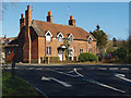
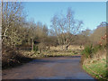
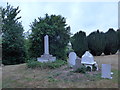
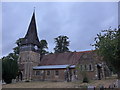
38 photos from this area
Area Information
Key information about the GU47 8HD including its size, population, and administrative classification.
- Area Type
- Postcode
- Area Size
- 1.8 hectares
- Population
- 1133
- Population Density
- 1819 people/km²
House Prices in GU47 8HD
22
Properties
£492,747
Average Sold Price
£247,000
Lowest Price
£862,000
Highest Price
Showing 22 properties
| Address | Type | Beds | Baths | Last Sale Price | Last Sale Date | |
|---|---|---|---|---|---|---|
| 13 St Michaels Road, Sandhurst, GU47 8HD | Detached | 4 | 2 | £685,000 | Oct 2025 | |
| 5 St Michaels Road, Sandhurst, GU47 8HD | Chalet | 4 | 2 | £640,000 | Mar 2025 | |
| 1 St Michaels Road, Sandhurst, GU47 8HD | Detached | 4 | 3 | £862,000 | Dec 2023 | |
| 7 St Michaels Road, Sandhurst, GU47 8HD | Semi-detached | 3 | 2 | £585,000 | Nov 2023 | |
| 41 St Michaels Road, Sandhurst, GU47 8HD | Detached | 5 | 2 | £635,000 | Nov 2021 | |
| 39 St Michaels Road, Sandhurst, GU47 8HD | house | - | - | £535,000 | Sep 2021 | |
| 23 St Michaels Road, Sandhurst, GU47 8HD | house | - | - | £425,000 | Oct 2020 | |
| 15 St Michaels Road, Sandhurst, GU47 8HD | Semi-detached | 4 | 2 | £493,000 | Aug 2019 | |
| 43 St Michaels Road, Sandhurst, GU47 8HD | Detached | 4 | - | £825,000 | Sep 2018 | |
| 37 St Michaels Road, Sandhurst, GU47 8HD | Bungalow | 2 | 1 | £447,000 | May 2018 |
Page 1 of 3
Energy Efficiency in GU47 8HD
Amenities
Schools
| Rank | School | Type | Entry gender | Ages |
|---|
Explore more schools in this area
Go to Schools tabDemographics
Household Size
Two person
most common
Accommodation Type
Houses
most common
Tenure
90
majority
Ethnic Group
White
most common
Religion
N/A
most common
Household Composition
N/A
most common
Age
47
median
Adults (30-64 years)
most common
Household Deprivation
N/A
with no deprivation
NS-SEC
46
in Lower managerial occupations
Explore more demographic insights in this area
Go to Demographics tabPlanning
Planning Constraints
- Flood RiskPremium
- Ramsar Wetland SitesPremium
- Area of Outstanding Natural BeautyPremium
- Protected Nature ReservePremium
- Protected WoodlandPremium