Area Overview for GU47 8HQ
Photos of GU47 8HQ
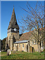
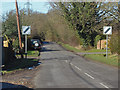
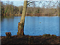
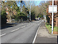
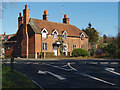
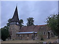
38 photos from this area
Area Information
Key information about the GU47 8HQ including its size, population, and administrative classification.
- Area Type
- Postcode
- Area Size
- 6937 m²
- Population
- 1133
- Population Density
- 1819 people/km²
House Prices in GU47 8HQ
9
Properties
£351,214
Average Sold Price
£156,000
Lowest Price
£580,000
Highest Price
Showing 9 properties
| Address | Type | Beds | Baths | Last Sale Price | Last Sale Date | |
|---|---|---|---|---|---|---|
| 2 Rectory Close, Sandhurst, GU47 8HQ | Detached | 5 | 2 | £580,000 | May 2019 | |
| Barnesway, 5 Rectory Close, Sandhurst, GU47 8HQ | Bungalow | 2 | - | £450,000 | Jul 2016 | |
| 7 Rectory Close, Sandhurst, GU47 8HQ | Semi-detached | - | - | £283,000 | Sep 2012 | |
| 6 Rectory Close, Sandhurst, GU47 8HQ | house | - | - | £327,500 | Jun 2012 | |
| 8 Rectory Close, Sandhurst, GU47 8HQ | Semi-detached | - | - | £312,000 | Oct 2007 | |
| 9 Rectory Close, Sandhurst, GU47 8HQ | Detached | - | - | £350,000 | Aug 2006 | |
| 1 Rectory Close, Sandhurst, GU47 8HQ | Detached | - | - | £156,000 | Nov 1997 | |
| Oakenfield, 3 Rectory Close, Sandhurst, GU47 8HQ | Detached | - | - | - | - | |
| 4 Rectory Close, Sandhurst, GU47 8HQ | Detached | - | - | - | - |
Energy Efficiency in GU47 8HQ
Amenities
Schools
| Rank | School | Type | Entry gender | Ages |
|---|
Explore more schools in this area
Go to Schools tabDemographics
Household Size
Two person
most common
Accommodation Type
Houses
most common
Tenure
90
majority
Ethnic Group
White
most common
Religion
N/A
most common
Household Composition
N/A
most common
Age
47
median
Adults (30-64 years)
most common
Household Deprivation
N/A
with no deprivation
NS-SEC
46
in Lower managerial occupations
Explore more demographic insights in this area
Go to Demographics tabPlanning
Planning Constraints
- Flood RiskPremium
- Ramsar Wetland SitesPremium
- Area of Outstanding Natural BeautyPremium
- Protected Nature ReservePremium
- Protected WoodlandPremium